


Shoja
A small forest village at around 2,700 metres, 5 km below Jalori Pass, the quieter and higher base for travellers who want silence after dark and a shorter drive to the Banjar valley trailheads
What makes it special
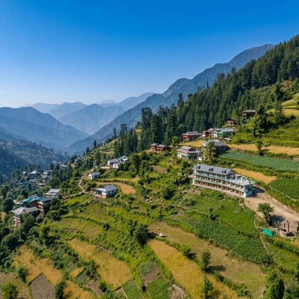
Shoja is a small village in the Seraj region of Kullu district, sitting at roughly 2,700 metres on the road between Jibhi and Jalori Pass. About 5 km below the pass and 7 to 10 km above Jibhi, depending on which signboard you trust. Higher than Jibhi, colder at night, and quieter after dark. The standard high altitude base for travellers who want to be close to the Jalori trailheads without sleeping in the bigger village down the road.
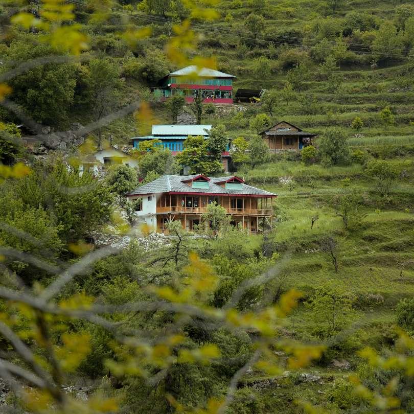
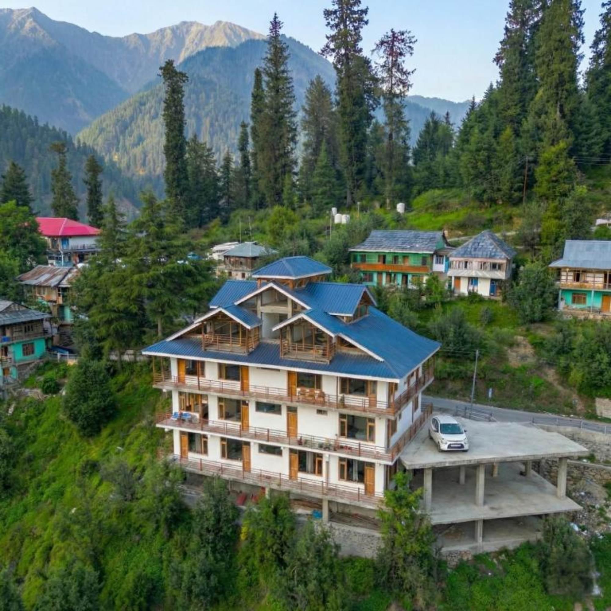
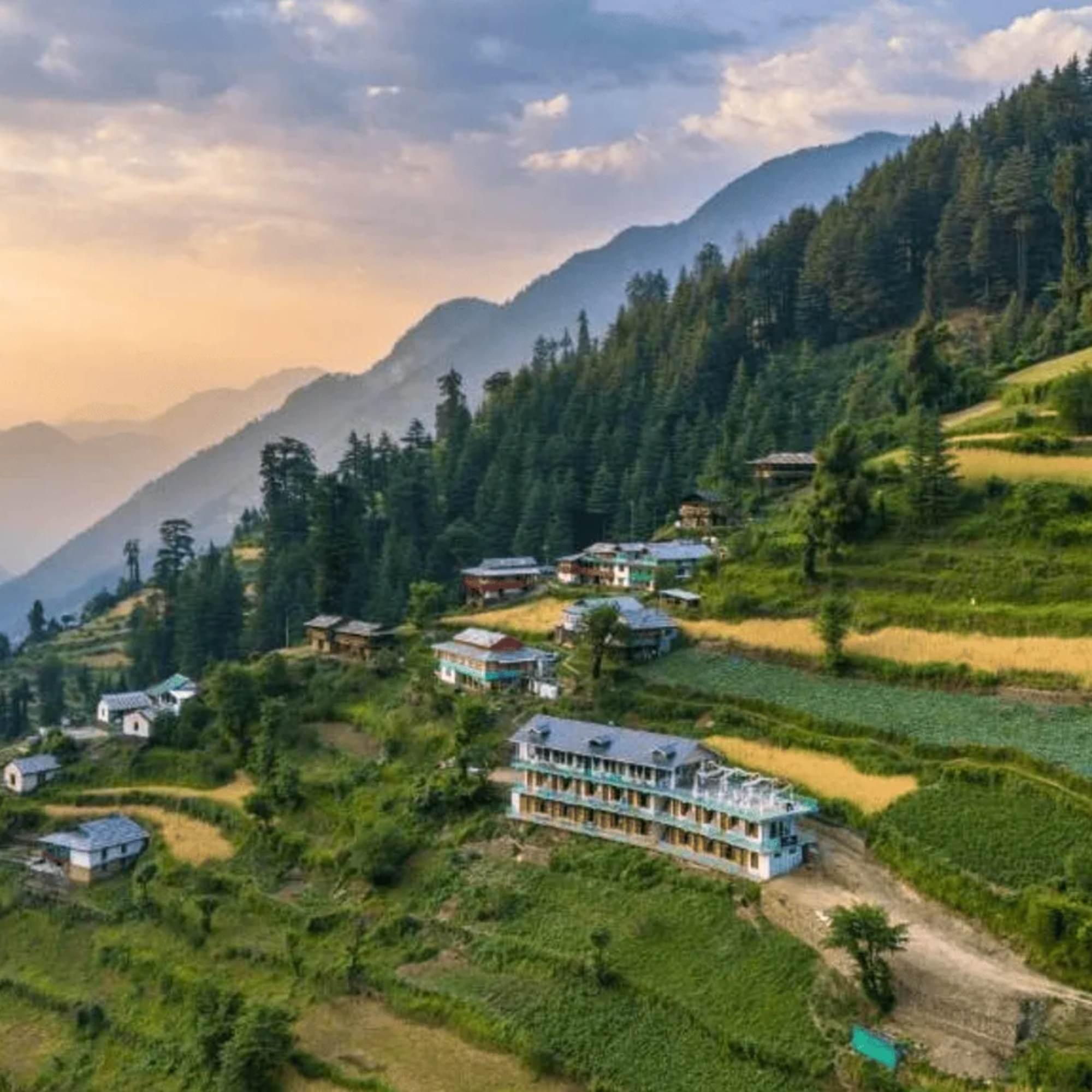
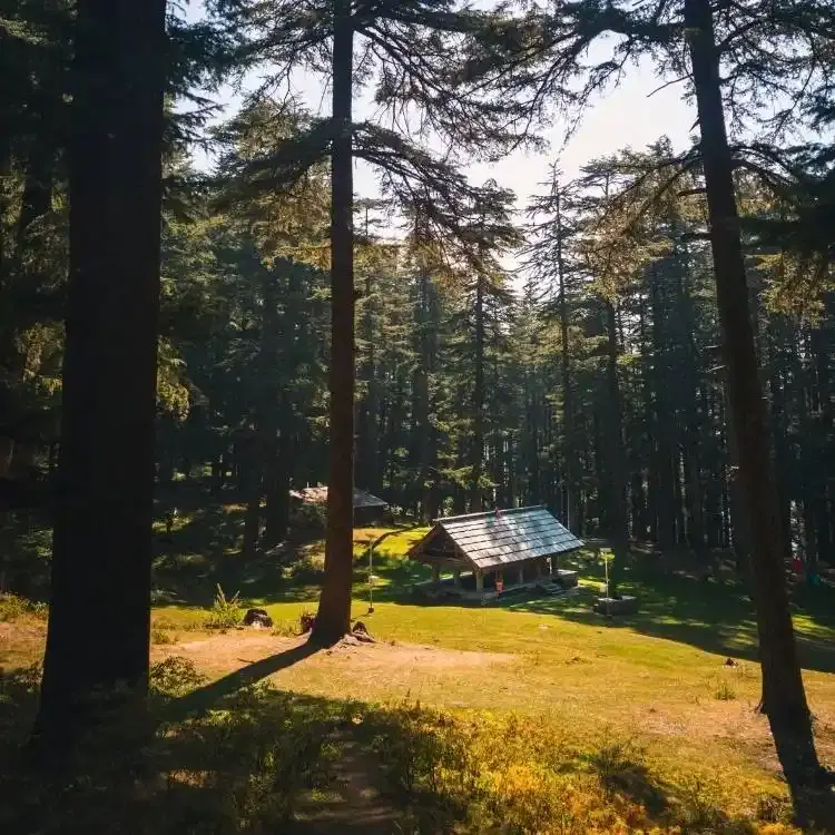
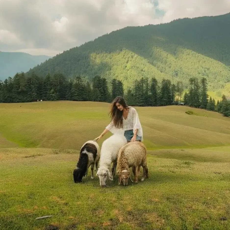
There is not a lot to it. A scatter of stone and timber homes along a tarred road, deodar forest pressing in on every side, an apple orchard or two, a Forest Rest House, a handful of homestays and small hostels that have opened in the last few years, and one or two cafes that come and go with the season. The village does not have a big bazaar, a famous temple, or a single must see attraction. What it has is height, silence, and proximity to the mountain.
The honest framing most pages skip is what this means for your trip. If you came to the Banjar valley to do the Jalori day walks and to spend two unhurried mornings reading on a wooden balcony with a view, this is the better base. If you came to drift between cafes, eat well, and meet other travellers in the evening, Jibhi is a better fit. Pick by the kind of day you want, not by which name showed up first on Instagram.
Is Shoja worth visiting?
Yes if you want a quiet, higher altitude base than Jibhi, plan to do the Jalori Pass day walks, or actively want snow in winter. The village is small and the food options are limited, but the deodar forest, the silence after dark, and the 20 minute drive to the trailhead are the trade off and most travellers think it is a good one. Skip it if you want cafes, nightlife, or a wider menu of things to do, base in Jibhi instead.
How much time do you need in Shoja?
Two nights minimum, three or four is better. One night feels rushed because the slow pace is half the point, and you spend most of your morning packing. Three nights gives you one slow day, one Jalori day walk, and one combined Jibhi or Chehni Kothi day. Five or more nights starts to drag unless you are working remotely from a homestay balcony.
Can you stay in Shoja?
Yes, mostly small homestays and a handful of backpacker hostels that have opened in recent years. Rooms run roughly 1,500 to 3,500 a night depending on season and quality, dorm beds around 700 to 1,000. Book ahead in peak season, the village does not have surge capacity. Read recent guest reviews from the last six months before you commit.
Quick facts
Everything you need to know at a glance
At a glance
On the ground
Seasonal weather
Suitable for
How to reach Shoja
4 approach routes with seasonal access
From Jibhi
Year round. Can shut briefly during heavy snow in deep winter, ask locally before driving up.The standard short hop. Drive uphill from Jibhi on the tarred road that climbs through Ghayagi towards Jalori Pass. The village sits about halfway up. Narrow tarred road with hairpins, fine in any small car or taxi when dry. Most travellers either self drive from Jibhi or take a local taxi for around 700 to 1,000 rupees one way. The drive itself is the prettiest part of the day.
Fuel stop: No fuel at Jibhi or Shoja. Tank up at Banjar or Aut on the way in.
From Banjar
Year round, with the same brief winter closure caveat for deep snow.Drive out of Banjar on NH 305 towards Jibhi, continue past Jibhi, and keep climbing on the same road until you reach the village. The full drive takes 30 to 45 minutes depending on traffic and weather. Local shared taxis run this route in season for around 100 rupees per head, private hire for 1,000 to 1,500.
Fuel stop: Banjar itself, the last reliable fuel before the climb.
From Delhi or Chandigarh
Year round on the approach to Banjar and Jibhi. Only the village access road can shut briefly in deep winter.Most travellers reach via an overnight Volvo from Delhi to Aut, just before the Aut tunnel on the Manali highway. From Aut, hire a taxi to Shoja for around 2,500 to 3,500 rupees one way, or take a local bus to Banjar and a shared jeep onwards. Self drive from Delhi takes 12 to 14 hours, broken either with an early morning start or a stop in Mandi. Aut is the key turn off, easy to sail past at night.
Fuel stop: Chandigarh, Swarghat, Bilaspur, Sundernagar, Aut, Banjar.
From Bhuntar Airport
Year round. Flights to Bhuntar can be cancelled in poor weather, particularly in winter.Bhuntar (Kullu Manali) is the closest airport, about 70 km away. Hire a taxi for around 2,500 to 4,000 rupees, allow 2 to 2.5 hours including a tea stop. The route runs back through the Aut tunnel, then NH 305 into the Banjar valley, then up through Jibhi to the village. Flights are seasonal and weather sensitive, so most travellers still come overland.
Fuel stop: Bhuntar, then Aut and Banjar.
Best time to visit
Season-by-season breakdown to help you plan
The cleanest window of the year once the pass road clears
Usually the best window of the year along with autumn. The Jalori Pass road clears some time in April, the deodar forest greens up, and afternoons stay clear of the heavy cloud build up that comes later. Mornings are cold even in May, carry a warm layer. Weekends in May and June get busier, weekdays stay calm. April brings the first wildflowers to the slopes and a particular quality of clean light that holds through till mid June.
Skippable unless you actively like monsoon weather
Most travellers skip these two months and it is a fair call. The village stays cool but the road from Mandi up to Aut sees regular landslides, the Jalori day walks turn slick and leech prone, and the views vanish into mist most afternoons. Photographers who actively want monsoon mist photos sometimes plan around this. If you do come in August, plan around weather, carry a proper rain shell, and do not start a higher walk in a thunderstorm.
The sharpest air of the year, gold in the orchards
If you can time it, late September to mid October is the sharpest window of the year. Post monsoon air clears the haze across the Pir Panjal, the apple orchards on the lower slopes turn, and the light goes the cleanest it gets all year. Weekdays are quiet, weekends in October get busy with travellers from Delhi and Chandigarh. By early November the nights bite, carry a real warm layer. First snow at the pass usually falls some time in the first half of November and the road shuts soon after.
Snow on the deodar, wood fire evenings, and a quiet village
The village stays open all winter and a winter visit has its own quiet appeal, with snow on the deodar forest and the village mostly to yourself. The Jalori Pass road shuts after the first heavy snow, usually mid to late November, and reopens some time in March or April, which means the upper day walks are off the table. What works in winter is short snow walks in the village forest, long evenings by a wood fire, and reading. Real cold and short daylight are the trade offs. Always check road status before driving up after fresh snow.
Things to see & do
10 experiences at Shoja
Wander the village and the forest
30 minutes to 2 hours, anytimeThe most honest answer for what to do here. Walk out of your homestay in any direction and you are inside deodar forest within five minutes. The road that climbs towards Jalori Pass is itself a fine slow walk for an hour, with the valley dropping away on one side and the trees closing in on the other. No marked trails, no fees, no plan needed. Carry a warm layer and a water bottle, and wear shoes with grip if the ground is wet.
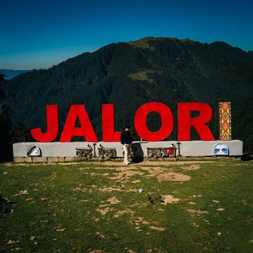
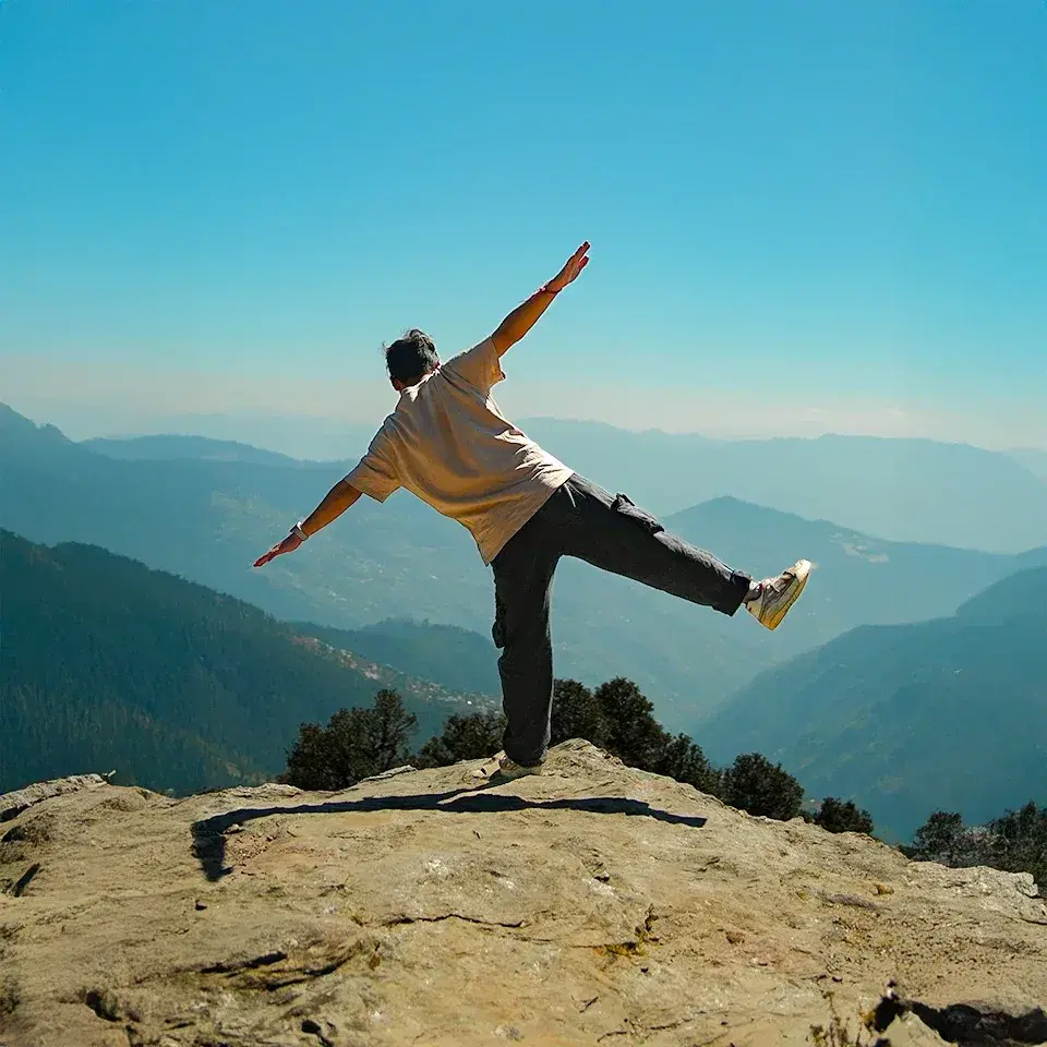
Drive or walk up to Jalori Pass
Half to full dayThe closest base to the trailhead, about 5 km away by road. A morning taxi up costs around 800 to 1,200 rupees return with a few hours of wait time. Self drive is fine if you are used to mountain roads. The genuinely fit can walk up from the village in about 90 minutes and earn the rajma chawal at the dhabas at the top. Read our Jalori Pass guide for the full picture before you head out.
Use Shoja as the launchpad for the Jalori day walks
Half day for the 360 Viewpoint, 2 to 3 hours for Raghupur, 5 to 6 hours for SerolsarJalori Pass is the trailhead for three day walks, all close to the same altitude. Serolsar Lake is the longest and easiest, 5 km each way through shaded oak forest to a small sacred lake. Raghupur Fort Trek is shorter and steeper, 3 km each way to a meadow ridge with the widest views in the area. The 360 Viewpoint is the quickest, a 45 minute climb to a panorama. Pick one a day, not all in a day. Each has its own page with the trail details.
Bird watching in the deodar forest
1 to 2 hours at dawnThe deodar and oak forests around the village are good ground for Himalayan monal, the state bird of Himachal, along with cheer pheasant, several thrush species, and Himalayan griffon vultures higher up. Dawn is much better than midday. Walk slowly out of the village onto the forest road towards the pass, pause for two minutes every few hundred metres, and you have a real chance of a clear monal sighting in shoulder season. Carry small binoculars if birding matters to you.
Slow down on a wooden balcony
As much as you can give itReading. Sleeping in. A long second cup of chai on the balcony watching mist move across the ridges. This is what most travellers actually come up here for, even if they do not say so when they book. The cafes are limited, the wifi is patchy, and the village shuts down by about 9 PM, which is the point. Two or three days of this resets you in a way a busier hill town cannot.
Drive across the Outer Seraj side
Half dayWhen the road over the pass is clear, usually April to November, the Outer Seraj side falls away to a drier, more open landscape than the Banjar side. A short drive 10 to 15 km down the Khanag side and back is a good half day add on. The villages look different, the slopes feel less wooded, and the change in feel either side of one mountain pass is striking. Most travellers stay on the Jibhi side and miss this. Self drive only if you are comfortable on tight hairpins.
Snow walks and bonfire evenings in winter
1 to 3 daysBetween roughly mid November and February, the village gets real snow, sometimes 1 to 2 feet at a time. The Jalori Pass road shuts during this window, so the upper trails are off the table without a guide and proper gear. What you can do is walk in the village forests when the snow has settled, build snowmen on the road, and sit by a wood fire in your homestay through the long cold evenings. Ask your stay about local guides if you want to attempt a snow hike higher up. Always check the road status before driving up in winter.
Day trip to Chehni Kothi
Half day from ShojaIf you have a half day spare and have not done it from Jibhi yet, drive 25 to 30 minutes down towards Banjar, turn at the signboard for Bagi or Chainsi Marg, and walk up to the great Kath Kuni tower at Chehni village. The walk is short and steady, the orchards are pretty in any season, and the tower itself is one of the better surviving examples of traditional western Himalayan architecture. Our Chehni Kothi guide covers the climb in detail.
Trout fishing on the Tirthan
Half day with the driveThe Tirthan River runs about 30 km from the village by road and is one of the better stretches in Himachal for trout. Catch and release is the rule in most of the upper river. You need a permit from the Fisheries Department office at Larji or Banjar in season, and a local guide makes the difference between a quiet morning by the water and a fish actually landed. Plan a half day for it including the drive, and check current rules and licence fees with your homestay.
Eat siddu, madra and local Himachali food
Across your stayLunch and dinner at most homestays here is Himachali home food rather than restaurant food. Siddu, a steamed wheat bun usually filled with poppy seed paste or dal, served with ghee. Madra, a chickpea or rajma curry in a yoghurt base. Thukpa from the Tibetan side. Local rajma chawal that bears no resemblance to the Punjabi version. Ask your hosts what is on for the evening rather than ordering off a menu, and eat what they suggest. The food is the meal here, not a side experience.
Know before you visit Shoja
Essential information for planning your visit
Nearby attractions
Other places worth visiting nearby
 ~5 km · 20 min drive
The mountain pass on NH 305 above the village, the trailhead for the three day walks of the area. Closest village base to the pass at about 5 km below it.
 5 km drive + 5 km trek each way
A small sacred alpine lake reached by an easy 5 km forest walk from Jalori Pass, ending at a Budhi Nagin temple. The most popular day trek from the area.
 5 km drive + 3 km trek each way
A short steep day hike from Jalori Pass to a meadow ridge with old fort walls and a wide panorama. Pick this over Serolsar if you want bigger views and a real climb.
 ~7 to 10 km · 20 to 30 min drive
The neighbouring village down the road from Shoja, with the wider range of homestays and cafes in the area. 7 to 10 km below by road.
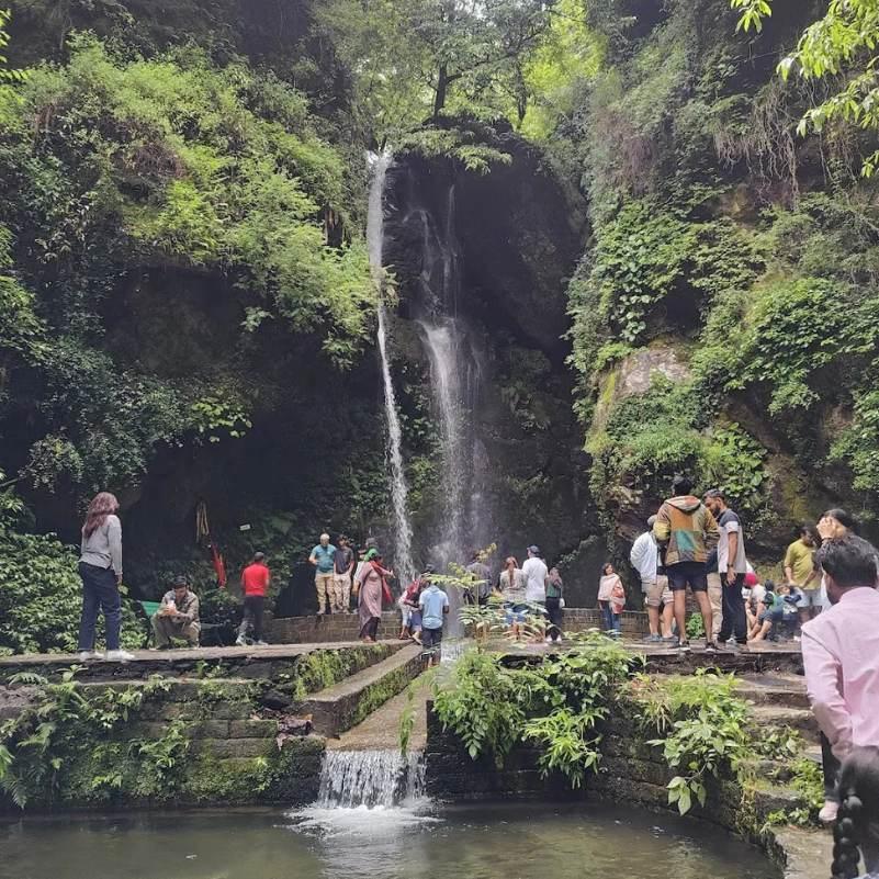 ~10 km from Shoja
A short waterfall a few minutes walk from the Jibhi bazaar. Easy stop on the drive down from Shoja for a half hour break.
 ~25 km · 1 hour drive to the walk start
A tall Kath Kuni stone and wood tower above Banjar, several centuries old, reached by a short uphill walk from Bagi or Bihar village.
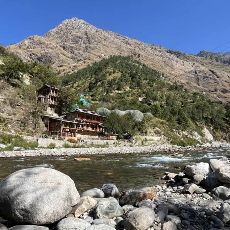 ~30 km · 1 hour drive
The river valley below the road, with trout fishing, riverside cafes, and trekking access into the Great Himalayan National Park.
 Tirthan entry ~30 km from Shoja
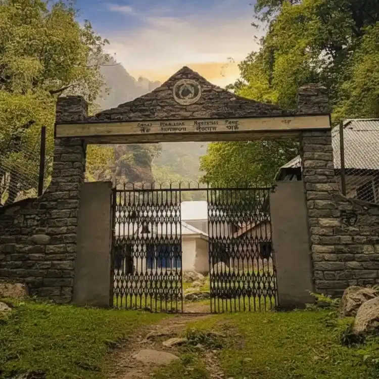
UNESCO World Heritage site covering the Tirthan, Sainj and Jiwa river catchments. Separate entry permits needed.
Our Packages with Shoja
Curated trips that include a visit to Shoja
Planning a trip that includes Shoja?
Not sure where to start? Just tell us your dates and what you're looking for, and we'll help you plan a trip that actually fits you.
Frequently Asked Questions
Related guides
- Jibhi for Honeymoon in 2026: Why Couples Choose It Over Manali
- Best Things to Do in Jibhi for Couples in 2026: Romantic Places, Walks and Hidden Gems
- Jibhi or Kasol — Which Is Better? An Honest, No-Fluff Comparison
- Jibhi in May: 15 Places to Visit, Best Things to Do, Jalori Pass Reality & Local Tips
- Jibhi and Tirthan Valley in March 2026: Weather, Jalori Pass, Best Places, Itinerary, and Local Tip
- Jibhi in April: Weather, Jalori Pass Status, Best Itinerary and What to Pack (2026 Guide)