

Kamru Fort
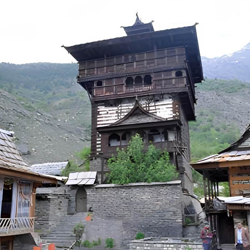
A multi-storey wooden tower and living temple above Sangla in the Baspa Valley, where weathered cedar carvings, Bushahr dynasty history, and active worship share a single hilltop
What makes it special
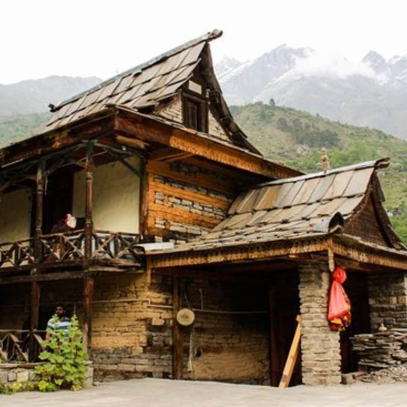
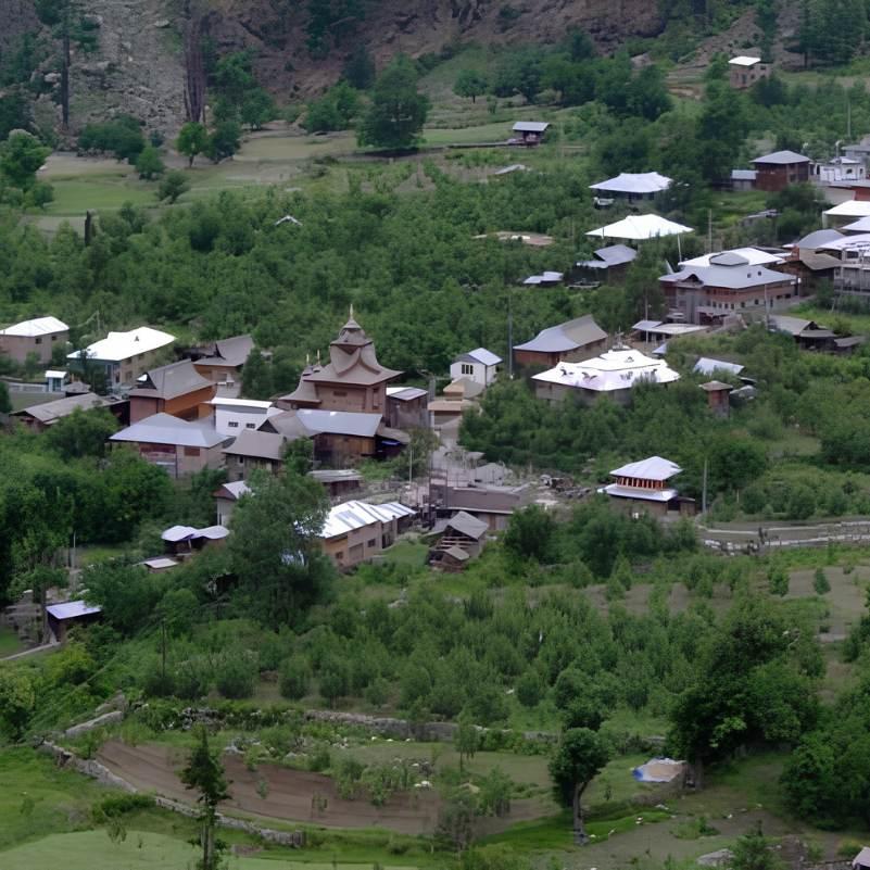
The lane out of Sangla market starts easy. Flat packed earth, apple orchards on either side, the smell of damp wood and cow dung that every Kinnaur village carries. Then it starts to climb. The houses crowd in, stacked stone and deodar timber with carved balconies and dark slate roofs worn to near black by decades of sun and rain. You hear somebody chopping wood two lanes over. A radio is playing through an open window. The air has a thin, clean bite to it that you do not get at lower elevations. This is Kamru village, and it does not care whether you are visiting or not.
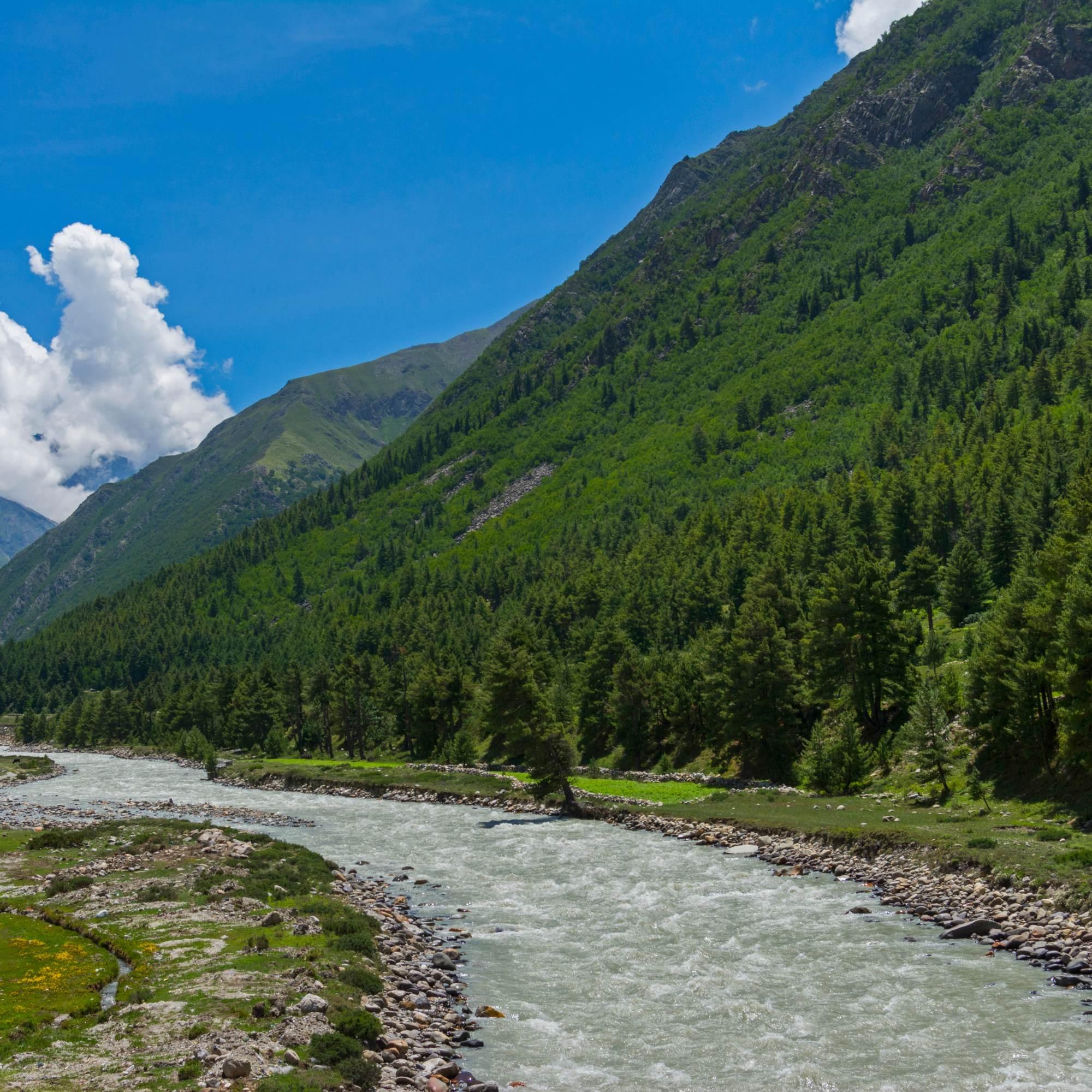
Then the stone paved steps begin. Roughly 300 of them, uneven, worn glossy by centuries of use. The climb takes most people 20 to 30 minutes, and your calves and lungs will feel every step at this altitude. Halfway up, stop and turn around. The Baspa River is a grey green thread far below, Sangla town a cluster of rooftops, and the ridgelines on both sides stack up until they disappear into haze. You see why the Bushahr kings chose this exact rocky spur for their seat of power.
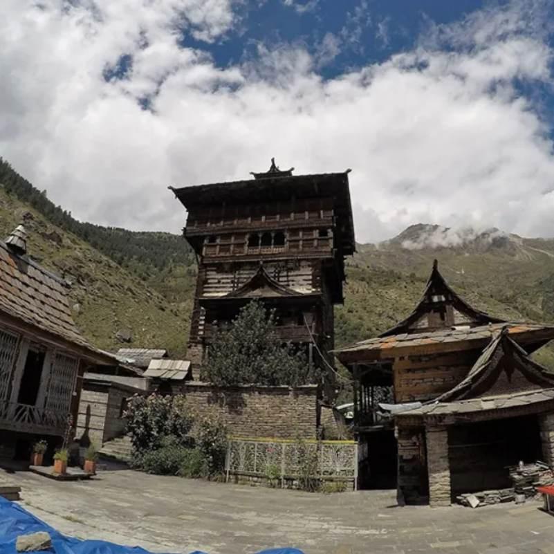
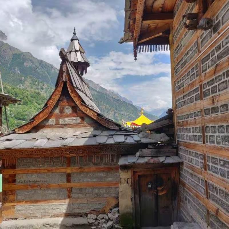
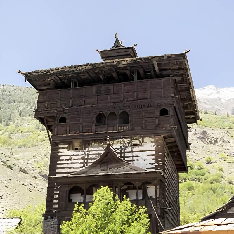
The fort complex itself is compact. You pass through a series of wooden gates, each one carved with deity figures and old ironwork. A small Buddhist shrine sits near the entrance. Inside the courtyard is the Badri Vishal temple, generally dated to around the 15th century. And then the tower. Multiple storeys of alternating weathered deodar cedar and stone, built in the traditional Kathkuni style, with a worn wooden balcony and prayer flags snapping in the valley wind. The idol of Kamakhya Devi, traditionally believed to have been brought here from Guwahati in Assam by the Bushahr kings, rests on one of the upper floors. A fair honouring the deity is held roughly once every three years.
Before you enter the temple area, you will be given a traditional Kinnauri cap and a Gachhi, the woven waist belt worn during worship in this region. Wearing both is mandatory, not optional, and they are provided right there at the entrance. Put them on properly. This is not dress up for a photo. It is how locals enter this space when they come to pray, and it is how the community expects you to enter too. Honestly, it is one of the things about Kamru that catches people off guard in the best way.
Now, the part you need to know clearly: the temple complex and courtyard are open, but the interior of the multi-storey wooden tower is generally locked to the public. Only the priest and members of the Bushahr royal family are allowed inside. This is a long standing tradition, not something you can talk your way around. Photography inside the temple and tower areas is also strictly prohibited. But what you get from outside, the carved deodar doors with their interlocking geometric patterns, the balcony up close, the view down the Baspa Valley with the river catching light below, that is the visit. And it is worth the climb.
Is Kamru Fort worth visiting?
Yes, and more than you might expect from a 90 minute stop. The walk up through Kamru village, past apple orchards and old wooden houses with dark slate roofs, is half the experience. At the top you get intricate Kathkuni wood carvings in weathered deodar cedar, a courtyard with real religious weight to it, and the Baspa River spread out far below. It is not a big ticketed heritage site. It is a living temple on a hilltop. That is exactly what makes it good.
Can you go inside the tower?
No. The temple complex and courtyard are open, but the multi-storey wooden tower is generally locked to the public. Only the priest and members of the Bushahr royal family go inside. Photography in the temple and tower areas is also strictly banned. Think of it less as a fort you tour and more as a sacred site you are invited to stand respectfully within.
How difficult is the climb?
Short but honest. You can drive from Sangla to the base of Kamru village, but the last stretch is roughly 300 stone paved steps, steep and uneven. Most people manage the uphill walk in 20 to 30 minutes with a few breaks along the way. Wear shoes with grip, not sandals. You are at roughly 2,600 metres, so the thin air makes everything feel harder than it looks.
Quick facts
Everything you need to know at a glance
At a glance
On the ground
Seasonal weather
Suitable for
How to reach Kamru Fort
3 approach routes with seasonal access
From Sangla town
Year round, though winter can make the steps icyFrom Sangla market, follow the lane uphill toward Kamru village. You can drive most of the way to the base of the village, or walk the whole thing through apple orchards and wooden houses with dark slate roofs. The last stretch to the fort is about 300 steep stone steps. Not driveable. The uphill walk from the village takes most people 20 to 30 minutes. Most people combine it with a morning or afternoon outing.
From Shimla
Generally April to OctoberThe standard route is Shimla to Rampur to Karcham, then the turn off into the Baspa Valley toward Sangla. Most people break this into two days, with a night at Sarahan or Narkanda. Doing it in one shot is exhausting and not advisable.
Fuel stop: Rampur, Reckong Peo
From Reckong Peo (Kinnaur district HQ)
Generally April to OctoberFrom Reckong Peo, drive down to Karcham on NH 5, then take the left fork into the Baspa Valley. The Sangla road is mostly surfaced but narrow. Fill fuel and withdraw cash in Reckong Peo before entering the valley.
Fuel stop: Reckong Peo
Best time to visit
Season-by-season breakdown to help you plan
The best window. Roads are open, the air is warm, and the fort steps are dry.
Days are pleasant and warm enough for a single layer. The walk through Kamru village is at its best when the apple orchards are green and the light is clear. This is also when most Kinnaur trips happen, so Sangla can feel busy on long weekends. Visit the fort early in the morning if you want it relatively quiet.
The valley turns green but the steps get slippery and the roads can be unreliable.
Sangla gets more rain than upper Kinnaur, and the stone steps to Kamru Fort can be genuinely slippery after a shower. The fort is still open and visitable, but the Kinnaur highway is landslide prone in this season, so your bigger concern is reaching Sangla at all. If you are already in the valley, pick a dry morning for the climb.
Crisp air, clean views, thinner crowds. Quietly the best season if you can handle cool evenings.
The valley light sharpens, the orchards are in harvest mode, and the fort complex feels unhurried. Evenings get cold quickly, so carry a proper jacket. This is a great time for photography, with clear ridgelines and warm afternoon light on the wooden tower.
Cold, quiet, and the steps can be icy. Only for travellers already comfortable with winter mountain travel.
Snow can fall in Sangla and the path to Kamru Fort can freeze over. The temple is still active and you can visit if conditions allow, but this is not the season for casual sightseeing. Roads to Sangla may also be disrupted after heavy snowfall.
Things to see & do
4 experiences at Kamru Fort
Walk through Kamru village to the fort
20 to 30 min one waySeriously, do not skip this for a taxi ride. The lane from Sangla winds through apple orchards where you can smell the fruit in season, then past old Kinnauri houses with dark slate roofs and carved balconies blackened by decades of woodsmoke. You pass small shrines with faded marigolds, stacked firewood drying against stone walls, and maybe a couple of goats blocking the path. The stone paved steps begin about halfway. They are uneven and worn smooth, and by the time you reach the first carved gate, you can hear the Baspa River below and your own breathing above. Walk the whole way if your knees allow it. Driving past all this means missing the best part.
Wear the Kinnauri cap and Gachhi, then explore the courtyard
20 to 30 minAt the entrance to the temple area, someone will hand you a traditional Kinnauri cap and a Gachhi, the woven waist belt. Wearing both is mandatory. They are not souvenirs. They are how the community enters this sacred space, and they are how they expect you to enter it too. Take a moment to put them on properly. Once inside, you will see the Badri Vishal temple (generally dated to around the 15th century), a small Buddhist shrine, and carved wooden gates with fine metalwork and deity figures. Run your eyes along the wood carvings slowly. The detail on the weathered deodar panels, flowers and animals and interlocking geometric patterns, is the kind of craftsmanship that barely exists anymore outside a few Kathkuni structures in Kinnaur.
Stand at the base of the tower and look up
15 to 20 minThe multi-storey wooden tower is the centrepiece, and your first reaction will probably be to just stand there looking up. Weathered deodar beams, rough stone courses, the old balcony, prayer flags pulling in the valley wind. You cannot go inside. The tower is generally locked to all visitors, and photography in the temple and tower areas is strictly banned. But if the priest or a caretaker is nearby and willing to talk, ask about the fort. They sometimes share stories about the Bushahr kings and the Kamakhya Devi idol, traditionally believed to have been brought all the way from Guwahati in Assam. Those conversations, when they happen, are worth more than any photo.
Sit with the valley and the Baspa below
10 to 15 minFrom the courtyard, you look straight down the Baspa Valley. The river is a grey green line far below, Sangla town looks like a handful of scattered rooftops, and the terraced fields and ridgelines stack up on both sides. On a clear morning the depth of view is startling. Do not just glance and leave. Sit on one of the stone ledges for five minutes. Let the wind do its thing. This is the view the Bushahr rulers looked at every day, and it is the reason the fort is where it is.
Know before you visit Kamru Fort
Essential information for planning your visit
Nearby attractions
Other places worth visiting nearby
 2 km downhill
Your base for visiting Kamru Fort. Walk along the Baspa river in the evening, explore the town market, and eat at one of the small restaurants. Sangla is where you sleep, eat, and recharge.
 Approx 3 km from Sangla
A quiet traditional village with old wooden houses and a Shakti temple. Less visited than Kamru, and a nice short walk from Sangla if you want another village experience without the steep climb.
 Approx 15 km from Sangla
A small hamlet on the road between Sangla and Chitkul, with a few homestays and a quiet riverside setting. A good lunch stop if you are driving to Chitkul.
 Approx 25 km from Sangla
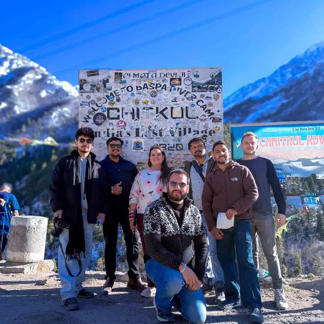
Often called the last inhabited village on the old Indo Tibet road. Most Sangla itineraries include a day trip to Chitkul. The drive up the Baspa Valley is worth it on its own.
 Approx 40 km from Sangla via Karcham
The other major stop in Kinnaur, known for its views of the Kinner Kailash range. Most travellers combine Sangla and Kalpa in a Kinnaur trip, spending a couple of nights at each.
 Approx 150 km from Sangla
A Buddhist village around a sacred high altitude lake in upper Kinnaur, on the road toward Spiti. Worth a night if you are continuing the Kinnaur to Spiti circuit.
Our Packages with Kamru Fort
Curated trips that include a visit to Kamru Fort

Planning a trip that includes Kamru Fort?
Not sure where to start? Just tell us your dates and what you're looking for, and we'll help you plan a trip that actually fits you.
Common questions about Kamru Fort
Related guides
- Shipki La Pass in September 2026: Weather, Permit, Road Status and Travel Guide
- Shipki La Pass in August 2026: Weather, Road Status, Permit Rules and Travel Tips
- Shipki La Pass in July 2026: Road, Permits, Weather and Travel Guide
- Shipki La Pass in June 2026: Road Status, Permits, Weather and Travel Guide
- Shipki La Pass in May 2026: Road Status, Permits and Honest Travel Advice
- Best Time to Visit Kinnaur Valley in 2026: Month-by-Month Guide