
Manali to Leh Highway 2026: Every Pass, Stop and Distance
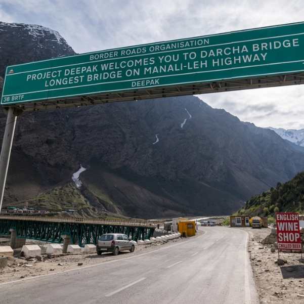
The Manali to Leh Highway in 2026 runs about 427 to 430 km through the Atal Tunnel and crosses four high passes, not five.
If you have read older blogs quoting 473 to 490 km and five passes, those describe the old road over Rohtang Pass, which the Atal Tunnel now skips. Getting this one fact right changes how you plan your days, your fuel stops, and your sleep altitude.
Quick Answer: How Long Is the Manali to Leh Highway in 2026?
The modern route via Atal Tunnel is roughly 427 to 430 km. It crosses four major passes: Baralacha La, Nakee La, Lachulung La and Tanglang La. Most travellers split the drive into two days, with Jispa as the usual first overnight stop.
If a website tells you 473 to 490 km and five passes, it is almost always describing the older Rohtang Pass alignment, which is a different, longer road. On the normal 2026 route, you go under Rohtang, not over it.
Planning the Himachal side of your trip properly matters as much as the Ladakh side, and our Manali tour packages can sort your base before you head north.
Why Do Some Websites Say 427 km and Others Say 475 or 490 km?
This is the single biggest confusion in Manali to Leh searches, and most tourists get it wrong before they even leave home.
The modern Atal Tunnel route
BRO reporting in 2026 described the restored Manali Leh Highway as 427 km. Current route measurements commonly land around 427 to 430 km. That is the road you will actually drive if you go through the tunnel, which nearly everyone does now.
The old Rohtang Pass route
The older alignment is about 474 km and climbed over Rohtang Pass before dropping into Lahaul. That extra distance and that extra pass are why old numbers still float around online. Those articles are not lying. They are just out of date.
So how many passes do you actually cross?
The normal Atal Tunnel route crosses four high passes. Rohtang only becomes a fifth if you deliberately take the old road over the top instead of the tunnel, which is a scenic detour, not the standard route.
If you are curious about what that old pass is like in early season, our guide to Rohtang Pass in May covers it honestly.
What Is the Exact Manali to Leh Route in 2026?
Here is the full run in order
Manali to Atal Tunnel to Sissu to Tandi to Keylong to Jispa to Darcha to Patseo or Zingzing Bar to Suraj Tal to Baralacha La to Sarchu to Gata Loops to Nakee La to Lachulung La to Pang to More Plains or Debring to Tanglang La to Rumtse to Upshi to Karu to Leh.
This article treats the Atal Tunnel alignment as the normal 2026 route, because that is what almost every traveller drives now.
The first stretch through Lahaul is also worth a stop in itself, and our Sissu tour packages show why people break the journey there instead of rushing past.
Manali to Leh Stop by Stop: What Comes After What?
Manali to Atal Tunnel
Manali to the Atal Tunnel south portal is about 25 km. This is the easy part, a proper climb on a developed road before the tunnel swallows you.
Atal Tunnel to Sissu
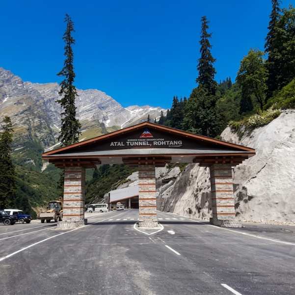
The Atal Tunnel is 9.02 km long. From the north portal to Sissu is about 7 km. The tunnel does the clever thing here. It bypasses Rohtang entirely and drops you straight into Lahaul, cutting out hours of slow pass driving and a lot of weather risk.
Sissu to Tandi, Keylong and Jispa
Sissu to Keylong is about 35 km by a 2026 route guide. Manali to Jispa via the current Atal Tunnel alignment is roughly 93 km, quoted at around 3 to 4 hours in normal conditions.
Mountain-road delays can stretch that, so treat it as a good day, not a promise. Keylong to Jispa is about 23 km.
Tandi and Keylong are your sensible zone for fuel, cash, supplies and last checks before the road goes remote.
Fuel availability can change seasonally, so it is best to refuel at Tandi or Keylong when possible rather than depend on a specific pump being operational later on the route.
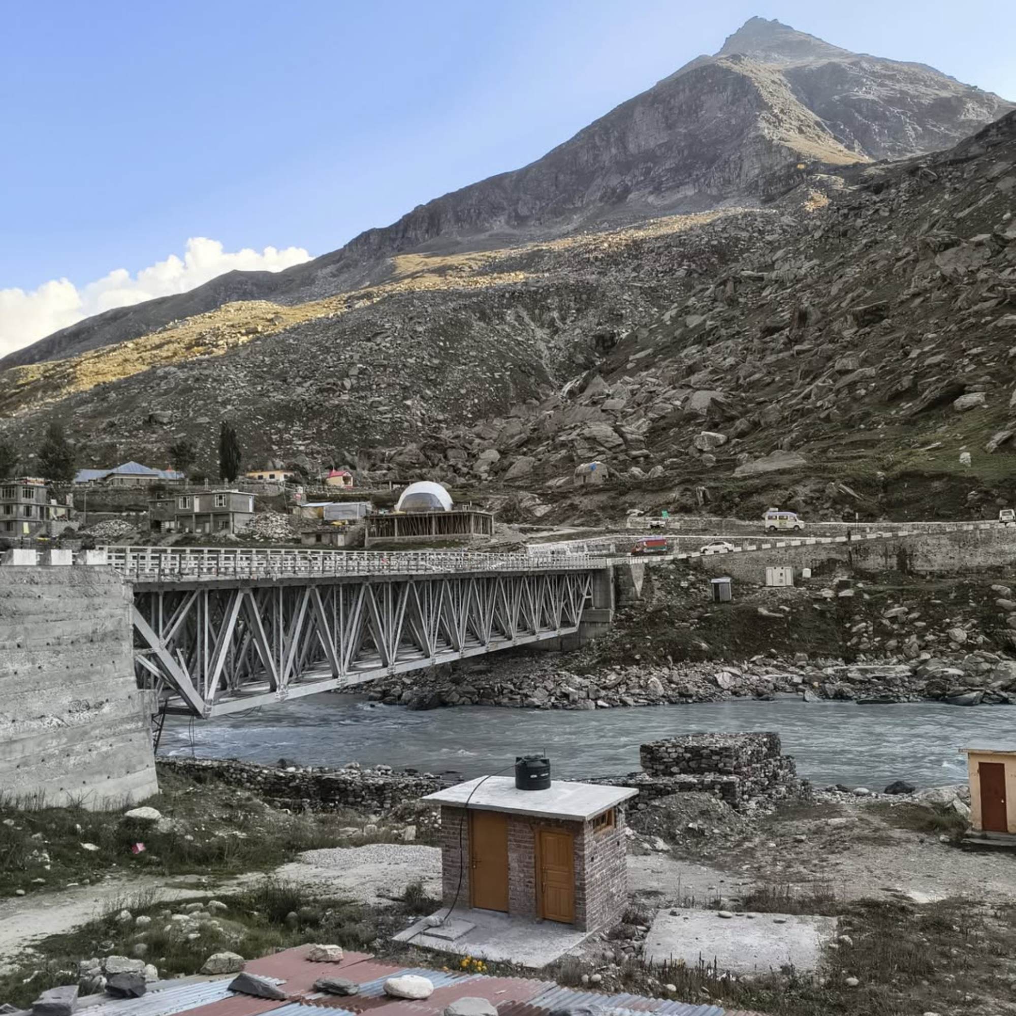
Jispa to Darcha and Zingzing Bar
Jispa to Darcha is about 7 km. Beyond Darcha, services thin out fast. What felt like a normal road with dhabas becomes long empty stretches, so top up your snacks and water while you still can.
Darcha to Baralacha La
From Darcha you climb past Patseo, Zingzing Bar and Suraj Tal on the way to Baralacha La at 4,890 m. Suraj Tal is a high lake that catches most people off guard with how blue it looks against bare rock. This is where the altitude starts to feel real.
Baralacha La to Sarchu
Baralacha La to Sarchu is about 32 km. Sarchu sits at roughly 4,200 to 4,253 m. It feels convenient because it lands near the middle of the highway, but it is a much higher place to sleep than Jispa. That gap matters more than the map suggests, and we will come back to it.
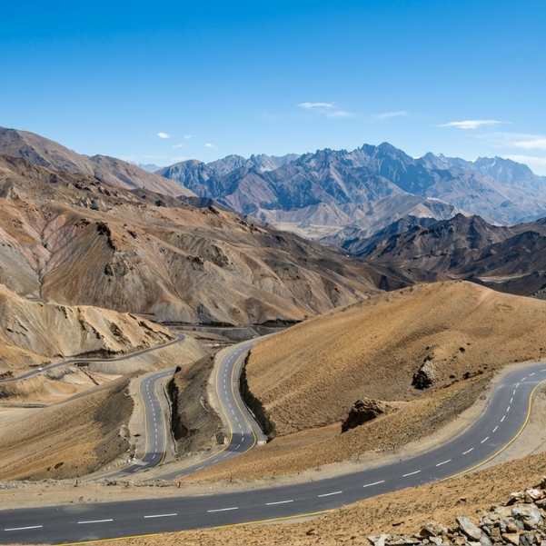
Sarchu to Gata Loops, Nakee La and Lachulung La
Sarchu to Pang is about 76 to 80 km depending on how you measure it. Along the way you hit the Gata Loops, 21 hairpin bends packed into roughly 7 km of climbing.
Then comes Nakee La at 4,739 m and Lachulung La at about 5,065 m. This is the most relentless high section of the whole drive.
Pang to More Plains and Tanglang La
Pang to Tanglang La is roughly 64 to 66 km. In between you cross More Plains, about 40 km of strange flat high-altitude tableland that feels nothing like the rest of the route.
Tanglang La stands at 5,328 m and is the highest pass on the normal Manali to Leh Highway.
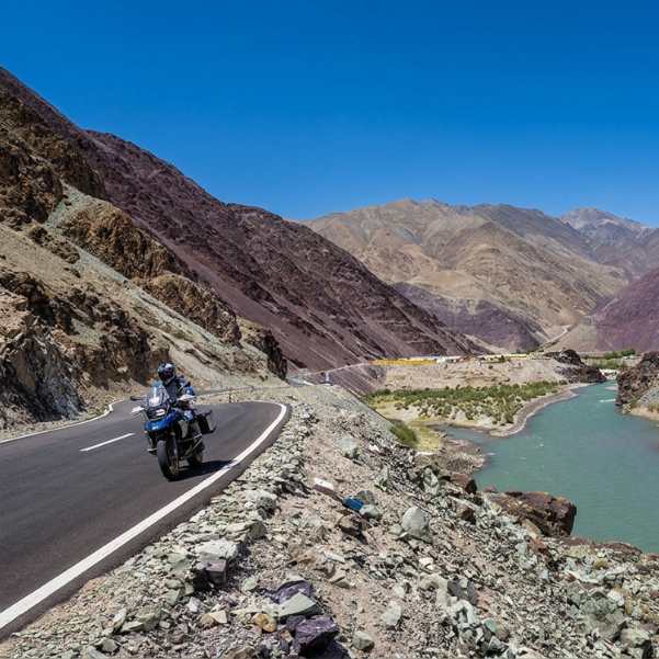
Tanglang La to Rumtse, Upshi, Karu and Leh
Tanglang La to Upshi is roughly 61 to 62 km. Upshi to Karu is about 14 km, and Karu to Leh is roughly 34 to 36 km. From here the road settles as you drop into the Indus Valley, and after two days of high passes, that green river valley feels like a reward.
If Ladakh is the real goal, our Leh Ladakh tour packages can handle the stays and permits once you arrive.
Which Four Passes Do You Cross on the Manali to Leh Highway?
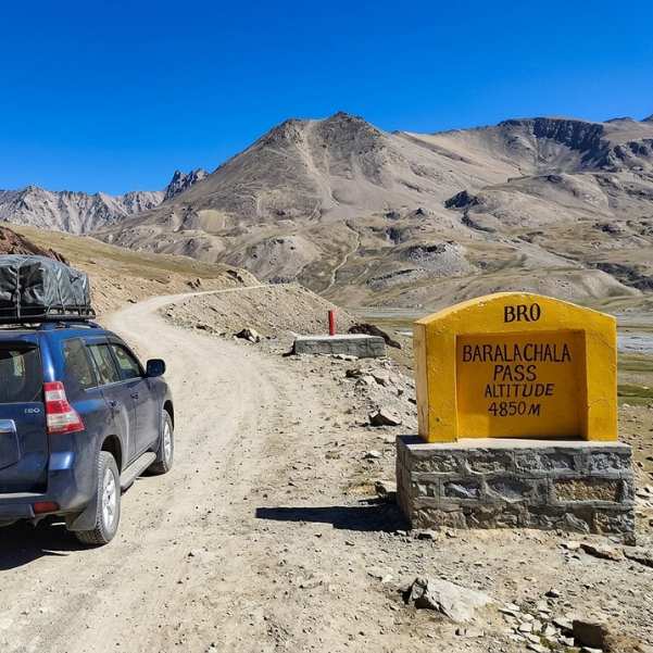
Baralacha La: 4,890 m
This is the first major high pass after Jispa and Darcha on the Atal Tunnel route. It is where a lot of travellers first notice thin air and a slower step.
Nakee La: 4,739 m
Nakee La follows the Gata Loops section. After 21 hairpins, the pass itself almost sneaks up on you.
Lachulung La: approximately 5,065 m
Lachulung La sits before Pang, deep in the highest and emptiest part of the route.
Tanglang La: 5,328 m
This is the highest point of the normal route, full stop. Once you are over it, the hard climbing is done.
And to repeat the correction that saves people real confusion: Rohtang Pass is bypassed by the Atal Tunnel, so it is not one of these four.
Is the Manali Leh Highway Open in 2026?
BRO connected the highway at Sarchu on 12 May 2026 after 42 days of snow clearance that began on 27 March. Light motor vehicle movement through the Baralacha La section resumed in mid-May 2026.
The official District Lahaul and Spiti road page, last updated 20 August 2026, showed Manali to Keylong open and Keylong to Leh open. A separate update dated 25 August 2026 reported full two-way traffic with all four passes open.
Then it got complicated. A local news report published on 1 September 2026 said fresh high-altitude snowfall temporarily closed the Manali to Keylong stretch, and the official district page has not been updated past 20 August.
The honest answer for today
The Manali Leh Highway can change from open to temporarily closed at short notice, so the latest road status should be checked with the Lahaul and Spiti administration or local authorities on the day of travel.
Himalayan roads flip within hours of snow, flash floods, landslides, roadwork or a police restriction. Our team recommends checking the Lahaul road status again on the morning you leave Manali, not a week before.
How Many Days Should You Take from Manali to Leh?
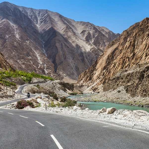
Two-day plan: Manali to Jispa, then Jispa to Leh
Day 1 is about 93 km to Jispa, a short, gentle start. Day 2 is roughly 334 km, quoted at around 9 to 10 hours of driving before any real sightseeing stops or delays.
That second day is long, no way around it, but it is the standard practical split for good reason. You get one easy day to settle in and one big push.
Is a three-day journey automatically safer?
An extra day can make the drive less rushed and give you more time at viewpoints.
But adding a night just to chop up the kilometres does not automatically help you acclimatise, especially if that night is at a much higher altitude. More days only help if you spend them sleeping lower, not higher.
Jispa or Sarchu: where should you sleep?
Jispa sits at about 3,200 m. Sarchu sits at roughly 4,200 to 4,253 m. That is a big difference for your first night out of Manali.
CDC Yellow Book guidance suggests that above 3,000 m, travellers should raise their sleeping altitude gradually, around 500 m a day where possible. That is general safety context, not medical advice for your specific body.
In our experience, Jispa makes much more sense than rushing straight to Sarchu on your first day, because it is substantially lower and gives an unacclimatised traveller a gentler night.
This is exactly what we tell our travellers when they ask where to break the drive. If anyone in your group has real altitude symptoms, do not keep climbing, and get proper medical help. We are not going to recommend any prescription drug here, because that is a doctor's call.
Where Are the Petrol Pumps on the Manali Leh Highway?
Sources genuinely conflict here, so read carefully. Tandi has long been one of the key fuel stops in Lahaul.
Current travel sources also report fuel availability at Keylong, but it is still safer to refuel whenever you get the opportunity rather than depend on one specific pump being operational.
The fuel gap from Tandi to Karu is commonly reported at roughly 330 to 365 km depending on the source and route point used, so plan with extra fuel margin instead of relying on one exact distance.
Do not treat informal bottled fuel sold along the way as guaranteed. Some days it is there, some days it is not, and the price reflects how far it travelled.
What About ATMs, Food and Mobile Network?
Keylong is widely reported as the last dependable ATM and cash point before the remote section. Draw what you need there and carry small notes, because dhabas and camps up ahead rarely take cards or UPI.
Food gets basic and seasonal after Darcha, with roadside tents around Sarchu and Pang during the season serving simple hot meals.
The hot Maggi and chai at the Pang tents is nothing fancy, but at that altitude and cold, it lands better than most restaurant meals you will remember.
Mobile coverage is patchy across the Manali Leh Highway, so do not rely on any one operator working throughout the route. Download offline maps and share your travel plan before entering the low-network sections.
Do You Need a Permit for Manali to Leh in 2026?
Travelling via Atal Tunnel
You do not need a Rohtang tourism permit when you go through the Atal Tunnel, because the route does not cross Rohtang Pass. That trips up a lot of first-timers who read old permit advice.
What you should not skip: official information from the Himachal e-Aagman portal says vehicles entering District Lahaul and Spiti must apply for the relevant e-pass, e-permit or e-ticket for their movement.
Check e-Aagman before you leave and pick the category that matches your route.
Travelling over Rohtang Pass instead
If you deliberately take the old road over Rohtang, the official Rohtang tourism permit fee is ₹500, plus a congestion charge of ₹50 for cars, jeeps and MUVs.
Rohtang Pass access remains weather dependent, so check the latest official road status before planning to use the old Rohtang route.
Manali green tax
Vehicles registered outside Himachal Pradesh pay a green tax at Manali. It is ₹100 for a bike, ₹200 for an LMV, ₹300 for a passenger vehicle and ₹500 for a goods vehicle.
The green tax slip stays valid for seven days, which comfortably covers a Leh round trip if you are quick about it.
What Are Road Conditions Like Between Manali and Leh?
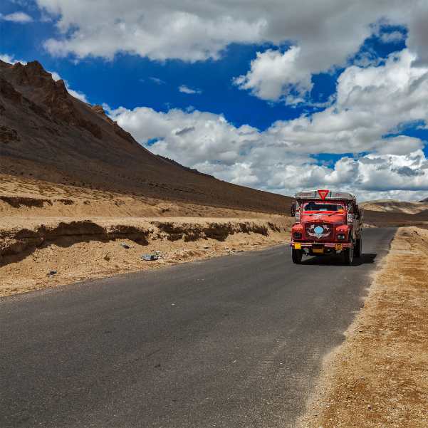
There is no single road rating for this highway, so think in sections. Manali to the Lahaul side through the Atal Tunnel is the most developed beginning, smooth and quick.
After Jispa and Darcha, the terrain turns higher and more isolated, and the road follows.
Baralacha La, Sarchu, the Gata Loops and the central high passes are the parts most exposed to snow damage, rough patches and water crossings, especially early and late in the season.
Then things generally settle again as you descend through Rumtse and Upshi toward Leh.
Treat every claim about today's surface as variable. We have seen how quickly a perfectly workable Himalayan road plan changes after fresh snow or a swollen nallah.
If you have a spare day in Manali before the drive, our guide to adventure activities in Manali covers ways to fill it well.
Can You Take a Sedan, SUV or Motorcycle?
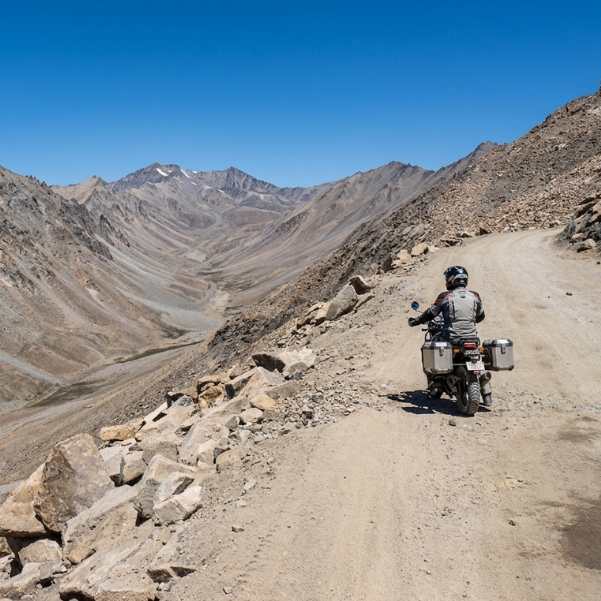
Smaller cars have finished this highway, especially when conditions are settled. But damaged patches and water crossings make ground clearance matter, so a low sedan will have you holding your breath in places.
We are not going to invent a minimum clearance number, because it depends on the road on the day.
An SUV gives you more margin, though 4WD is not universally or legally required. Motorcycles are hugely popular on this route, but any rental-union restriction you read about should be reverified right before you travel, because those rules shift.
Which Month Is Best for the Manali Leh Highway?
June
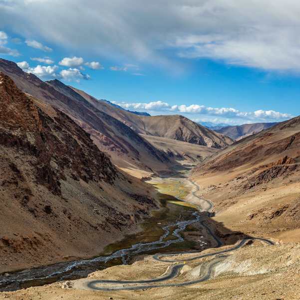
June is the freshly opened window, when you can still hit snow walls, slush and strong snowmelt on the passes. It is dramatic but rougher.
July and August
July and August are the established travel months. Much of Ladakh sits in a rain shadow, but the Himachal approach can still take monsoon hits, so keep a buffer day.
September
September is a favourite for more settled roads and clearer air, but early snowfall is always possible. That 1 September 2026 snowfall report that briefly closed Manali to Keylong is exactly why we never call September a sure thing.
Nobody can guarantee an exact October closing date either, because the weather decides, not the calendar.
Common Mistakes First-Time Travellers Make
The most common one is trusting Google Maps driving times as a real mountain itinerary. The app has no idea about a water crossing or a slow convoy behind a truck.
Right after that comes using an old 475 to 490 km figure without checking whether it means the Rohtang route, and then counting five passes when the normal Atal Tunnel route crosses four. Both come from reading stale articles.
People also assume "open" means it cannot close again later that same day, which the 2026 snowfall report disproves neatly.
Others automatically sleep at Sarchu just because it looks like the midpoint, ignoring how much higher it is than Jispa. And plenty leave Lahaul without sorting fuel, cash and supplies, then find nothing but empty roads for hours.
Explore Our Curated Leh Ladakh Tour Package
 6D/5N
6D/5NBest Selling Leh Ladakh Tour With Nubra Valley and Pangong Lake
2D Leh•1D Nubra Valley+1
₹23,999₹28,599SAVE INR 4,600/ person 9D/8N
9D/8NUltimate Ladakh With Hanle Umlingla Puga Valley and Tso Moriri
2D Leh•1D Nubra Valley+3
₹36,999₹44,999SAVE INR 8,000/ person Group Tour8D/7N
Most Loved Zanskar Valley 4x4 Group Expedition
1D Manali•1D Purne / Kargyak / Gonbo Rangjon Side+2
₹32,999/ person
Related topics
Frequently Asked Questions
What is the Manali to Leh distance via Atal Tunnel in 2026?
It is roughly 427 to 430 km. A 2026 BRO report described the restored highway as 427 km.
How many passes are there from Manali to Leh?
Four on the normal Atal Tunnel route: Baralacha La, Nakee La, Lachulung La and Tanglang La.
Does the Manali to Leh route still cross Rohtang Pass?
No. The Atal Tunnel bypasses Rohtang. You only cross it if you deliberately take the old road over the top.
Can Manali to Leh be completed in one day?
We do not advise it. The standard split is two days, usually with Jispa as the first night, and Day 2 alone is a long 9 to 10 hour drive.
Is Jispa or Sarchu better for the first night?
Jispa, for most people. At about 3,200 m it is far lower than Sarchu at roughly 4,200 m, which makes for a gentler first night out of Manali.
When did the Manali Leh Highway open in 2026?
BRO connected it at Sarchu on 12 May 2026, and light vehicle movement over Baralacha La resumed in mid-May.
Is the Manali Leh Highway open right now?
Current status can change quickly with snowfall, landslides or temporary traffic restrictions. Late August 2026 reports showed the highway open, but fresh snowfall on 1 September caused a temporary closure, so check the latest official road update on the morning you travel.
Do I need a permit through Atal Tunnel?
No Rohtang permit is needed via the tunnel. But you must apply on the Himachal e-Aagman portal for the relevant e-pass, e-permit or e-ticket to enter Lahaul and Spiti.
Where is the last petrol pump before Leh?
Tandi remains the safest major fuel stop to rely on, while fuel availability at Keylong can vary, so refuel whenever you get the opportunity before continuing toward Leh. The Tandi to Karu fuel gap is disputed, somewhere around 330 to 365 km, so carry a margin.
Can a sedan travel from Manali to Leh?
It has been done in settled conditions, but rough patches and water crossings make low ground clearance risky. An SUV gives you more room for error.
Does mobile network work on the highway?
Mobile coverage is patchy and changes by location, so do not depend on any one operator working across the entire highway. Download offline maps and share your travel plan before entering low-network sections.
What is the best month for driving from Manali to Leh?
July to September usually gives the most settled roads. June is dramatic but rougher, and September can surprise you with early snow, so keep a buffer day whenever you go.
More about Ladakh
 Ladakh
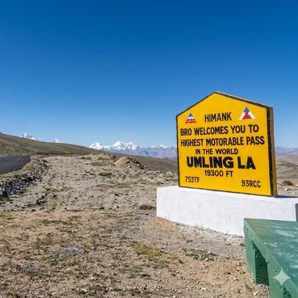
Umling La Ladakh Guide 2026: Route, Altitude, Permit, Safety & Reality Check
Planning to visit Umling La in 2026? This complete guide covers the route, altitude, permit requirements, road conditions, safety tips, and the realities of travelling to one of the world's highest motorable roads.
- Road Status
- Altitude & Health
 Ladakh
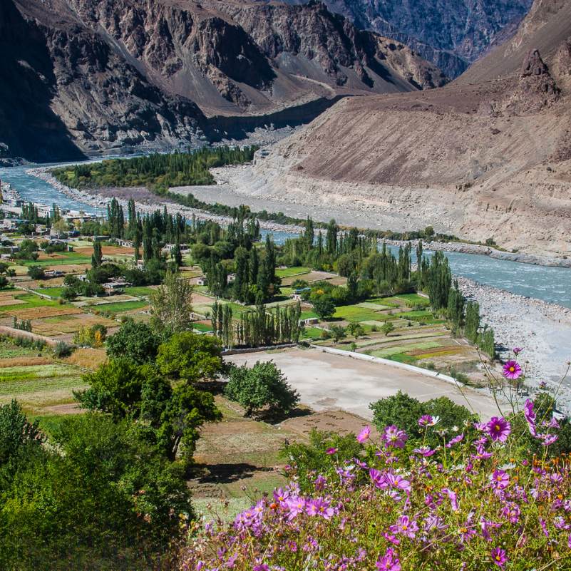
Turtuk Ladakh Travel Guide 2026: Balti Culture, Apricot Orchards and Why It Is Perfect for Families
Planning a trip to Turtuk? This 2026 travel guide explores the village's rich Balti culture, beautiful apricot orchards, top attractions, travel route, and why Turtuk is one of the best family-friendly destinations in Ladakh.
- Places to Visit
- Family Travel
 Ladakh
Offbeat Ladakh for Couples in 2026: Quiet Routes Beyond Pangong and Nubra
Looking for a peaceful Ladakh getaway? This 2026 guide explores quiet routes and hidden destinations beyond Pangong and Nubra, helping couples discover scenic landscapes, unique stays, and unforgettable offbeat experiences.
- Places to Visit
- Things to Do