
Chandratal Road Status 2026: Is Chandratal Lake Open Today?
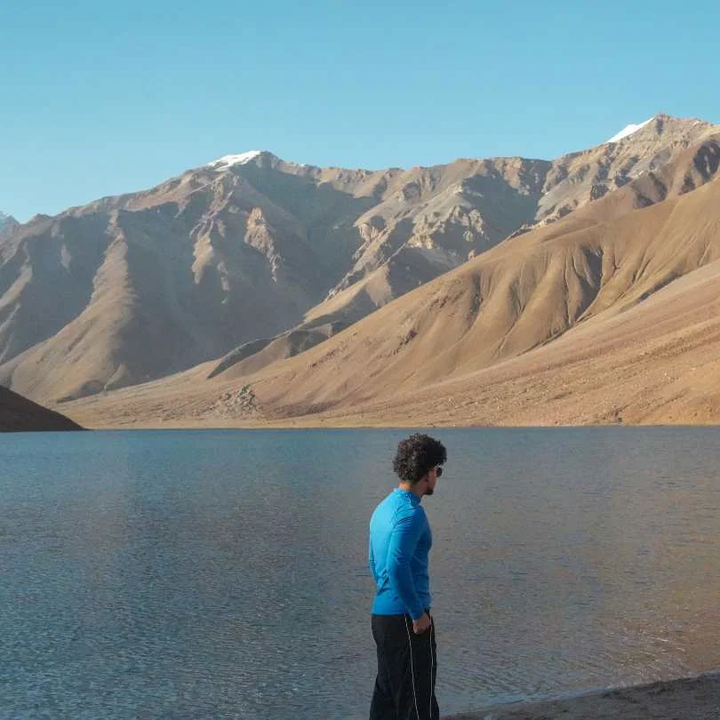
If you are searching for Chandratal road status 2026 right now, you probably have a trip planned and want to know one thing: can I go today? This page gives you that answer, updated with the latest information we have.
But here is the honest version. Road status in this part of Himachal changes faster than any blog can keep up with. What was open yesterday might be closed today because of a single overnight landslide or snowfall. So while this guide gives you the most current picture, always verify with a local source before you leave.
We are Travel Coffee, a Himachal based travel company that runs Spiti and Chandratal trips every season from our Shimla office. We will tell you what we know, flag what we are not sure about, and give you the right people to call for a same-day confirmation.
Last verified update: September 7, 2026.
Quick Answer: Is Chandratal Lake Open Today?
Yes. As of September 7, 2026, Chandratal Lake is open and the camps are running. Kunzum Pass, the Gramphu-Kaza-Sumdo highway, and the Batal to Chandratal diversion have all been through since June. This is peak season, and it is the most settled the access gets all year.
But the thing that decides your trip in early September is no longer snow. It is rain.
The southwest monsoon reached Himachal on June 30, 2026, and it has stayed active right through August and into September. The state has taken real damage. The useful part for you is that the damage is concentrated in Mandi, Kullu and the lower districts, not in Lahaul and Spiti. On the State Emergency Operation Centre report of September 5, 85 roads were blocked across Himachal, with Mandi (45) and Kullu (15) worst-hit. Lahaul and Spiti had just one blocked link road, and Kinnaur did not appear on the blocked list at all.
Here is the part that needs your attention. The state is in a relative lull of light showers right now, but the IMD has a fresh, more widespread spell of rain likely from around September 11. If your dates fall in that window, treat the approach roads as the variable, not the lake.
So the honest read for today: the lake is open, but you are heading into another active monsoon window. The risk is not at Chandratal. It is on the road you take to get there.
Do not leave for Chandratal unless the Batal diversion, camp status, weather, and road conditions are confirmed on the same morning you plan to travel. Not yesterday. Not based on a social media post from last week. The same morning.
Talk to our Himachal team on WhatsApp for a same-day ground check before you leave.
Today's Chandratal Status at a Glance
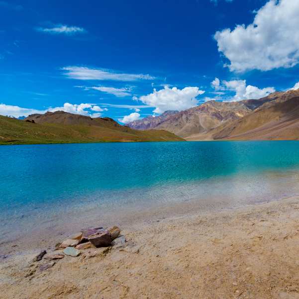
Kunzum Pass: Open. BRO cleared the winter snow from both sides in late May 2026 and the pass has been carrying traffic since. No closure reported on the latest reports.
Manali to Kaza / Gramphu-Kaza-Sumdo highway: Open. On the SEOC report of September 5, Lahaul and Spiti had just one blocked link road, none on this highway, and the heavy damage sat in Mandi and Kullu.
Batal to Chandratal diversion road: Open. This rough 14 km stretch cleared in June and has been carrying traffic through the season. By early September the surface is packed down and in far better shape than it was in early June, but it stays rough, and heavy rain can put water back across it within hours.
Camp status: Fully operational. Early September sits in the back half of the camping season and the camps near the lake are running with guests.
Safety status: Open, but weather-dependent. Rain has eased into light showers for now, but the IMD has a fresh, more widespread spell likely from around September 11. Access on the Manali side can be interrupted at short notice.
Weather note: Daytime highs at the lake sit in the mid to high teens Celsius, and nights still drop close to freezing. Chandratal itself sits in a rain shadow and stays comparatively dry, while the western districts and Kullu take the brunt of these spells. That is exactly why the approach road matters more than the lake right now.
Why "Kunzum Open" Does Not Mean "Chandratal Open"
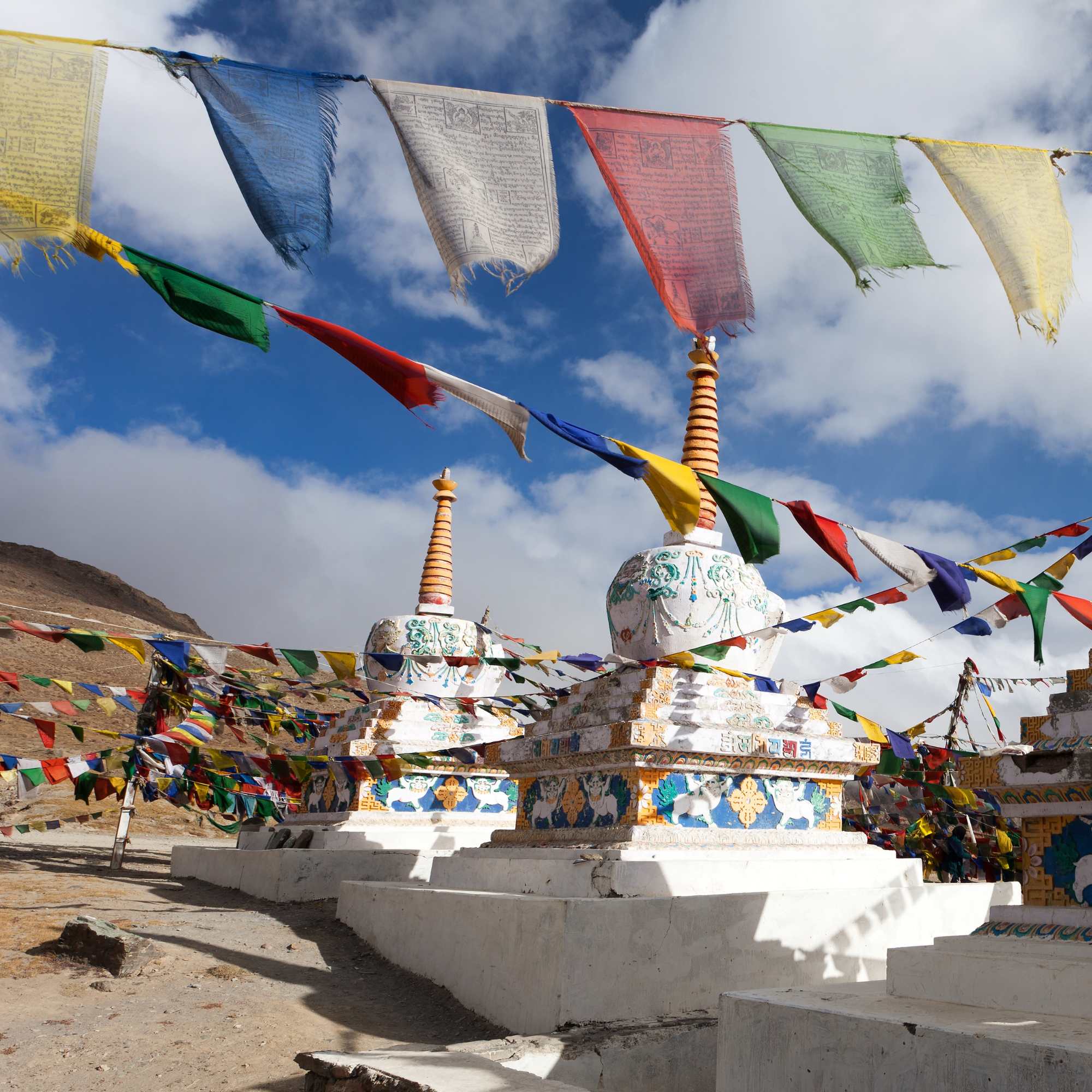
This is the biggest confusion we deal with every season. Travellers hear "Kunzum Pass is open" and assume they can drive straight to Chandratal Lake. That is not how it works.
There are three separate stages that need to happen before Chandratal is truly accessible.
First, Kunzum Pass opens. This makes the main Spiti to Manali crossing possible. BRO clears the snow, vehicles start moving, and news outlets report "highway open." This happened in late May 2026.
Second, the Batal to Chandratal diversion needs separate clearance. This is a rough, narrow, unpaved 14 km road that branches off the main highway near Batal and leads toward the lake. It has its own debris, its own water crossings, and its own timeline. Kunzum being open does not automatically clear this stretch.
Third, camps need to be operational. Chandratal is remote. There are no hotels, no restaurants, no shops. Overnight stays depend on seasonal camps that operators set up once conditions allow. Without camps, you have nowhere to stay, nothing to eat, and no backup if things go wrong.
All three stages are complete for 2026, so this is less of an issue in early September than it was in June. It matters again from late September, when the sequence runs in reverse and the diversion and camps close before the pass does.
In our experience helping travellers plan this route, the most common mistake is reaching Kaza or Manali thinking Chandratal is open because they saw a news headline about Kunzum. Then they find out the final diversion is still blocked or the camps are not ready. That is a wasted day at best and a dangerous situation at worst.
Latest 2026 Update: What Has Changed So Far?
The season opened on schedule. BRO reopened the Gramphu-Kaza-Sumdo highway via Kunzum Pass in the second half of May 2026 for light 4x4 vehicles, following the pattern set by 2024 and 2025. The Batal diversion cleared through June and the camps came online in the middle of that month. By early July, both approaches to Chandratal were working normally.
For reference, in 2025 the Kaza side became accessible around May 20 and the Manali side was fully open by early June. Campsites were operational from early June that year. In 2024, a similar timeline played out with full camp operations by the first week of June. The 2026 season tracked this same pattern.
What has changed since then is the weather.
The southwest monsoon entered Himachal on June 30, 2026 and spread across the state within a day. The first weeks were rough. By July 3, a cloudburst in Kinnaur sent debris across NH-5, and blocked roads across the state ran into the dozens. Blocked roads climbed to 69 by July 13, with Kullu accounting for 38 of them.
The monsoon stayed active through August and into September. Statewide blocked-road counts swung between roughly 100 and 185 through August as spells came and went, then eased through early September, standing at 85 on the September 5 SEOC report, with Mandi (45) and Kullu (15) worst-hit and Lahaul and Spiti down at just one. Across the season, statewide rainfall has run a little below normal, and Lahaul and Spiti has been among the driest parts of the state, sitting in the rain shadow while Kullu and Mandi absorbed the damage.
The IMD's Shimla centre has light to moderate rain continuing across the state, with a fresh, more widespread spell likely from around September 11. In that window, the risk sits squarely on the approach roads rather than at the lake.
Read practically: if your dates are flexible, aim for the drier windows between the spells.
For the full seasonal breakdown, our Chandratal 2026 opening guide covers it in detail.
Route-Wise Chandratal Road Status 2026
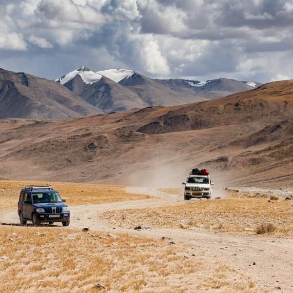
Manali to Chandratal Road Status Today
The route from the Manali side goes through Manali, Atal Tunnel, Sissu, Koksar, Gramphu, Batal, and then the Chandratal diversion. It is dramatic but rough, and in monsoon it is the exposed side of this trip.
The stretch from Manali to Sissu through the Atal Tunnel is smooth and fast. After that, the road quality drops. The section after Gramphu toward Batal can have bad patches, loose gravel, and active water crossings. This is the part that catches most travellers off guard, and it is the stretch that closes when the rain arrives.
Time your run. Water crossings on this stretch are at their lowest before 10 AM and get deeper through the afternoon as the day warms and any rain accumulates. Starting after 8 AM from Manali is asking for trouble. The drive takes 7 to 9 hours on a good day. On a bad day, it takes longer.
Do not attempt this as a casual same-day run from Manali unless the road is confirmed open, the weather is clear, and you have a high-clearance vehicle. Kullu district has carried among the highest road-blockage counts in Himachal all monsoon, including in the Manali subdivision, so check the day's position before you commit.
If you are planning a stop along this route, Sissu is a solid overnight halt before pushing further. Many of our travellers use Manali as the base and break the Chandratal drive into two days for comfort and safety.
Kaza to Chandratal Road Status Today
From the Kaza side, the route goes through Kaza, Losar, Kunzum Pass, Batal, and then the Chandratal diversion. The total distance is around 80 to 90 km depending on your exact start point and which side of Batal you take the diversion from.
This is the more dependable side in monsoon. Spiti sits in a rain shadow and has been among the driest parts of the state this season. It can still be raining hard in Kullu while Kaza stays dry.
This route is also better for travellers who have already spent a few days in Spiti and are properly acclimatised. You have had time to adjust to 12,500 feet at Kaza, your body is handling the altitude, and the drive to Chandratal feels less punishing.
A day trip from Kaza to Chandratal and back is possible when the road is fully open, but it is a long high-altitude day. Start before 6 AM. Do not attempt it if the weather forecast shows afternoon rain or cloud cover. And do not push it if anyone in your group is showing AMS symptoms.
If you are already planning a Spiti circuit, our Spiti Valley packages include Chandratal as a natural stop toward the end of the route, which is the safest way to approach it.
Batal to Chandratal Road Status Today
This is the decisive stretch. The Batal to Chandratal diversion is around 14 km. It is rough, narrow, unpaved, gravelly, and can have active water crossings. In monsoon those crossings are fed by rain rather than snowmelt, which makes them less predictable, not more: a clear morning can turn into a blocked track by evening.
This section is the real reason Chandratal often opens days or even weeks after Kunzum Pass. BRO clears the main highway first because it connects cities. The diversion to a lake is lower priority. The road gets cleared when it gets cleared.
Sedans are not recommended on this stretch. A high-clearance SUV or 4x4 is the safer choice. Even experienced local drivers slow down here because one wrong move on a loose patch can leave you stuck with no recovery support and no mobile signal.
Vehicles stop before the lake at a parking area. From there, travellers walk the final 1.5 to 2 km to the lakeshore. The walk takes about 20 to 30 minutes at altitude, so pace yourself.
Is Chandratal Safe to Visit Today?
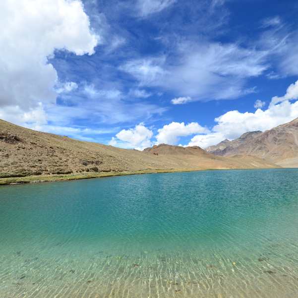
Chandratal is safe only when five things line up at the same time. Road open and confirmed. Weather stable with no storm forecasts. Correct vehicle for the terrain. Daylight travel only, no driving after dark. And proper acclimatisation, meaning you have spent at least one or two nights above 10,000 feet before reaching the lake.
In peak monsoon, the one that needs watching is the weather. The lake itself sits in a rain shadow and usually stays comparatively dry. The problem is that Chandratal has exactly one road in and out, and that road runs through terrain that does get hit.
This is not theoretical. In July 2023, heavy rain blocked the Gramphu-Kaza highway and more than 250 travellers were stranded at Chandratal for several days, with more stuck at Batal. Helicopters could not reach them because of the weather. They were eventually evacuated by road over Kunzum Pass to Losar after BRO and the district administration cleared the Batal-Chandratal link. Everyone got out safely, but the point stands: at Chandratal there is no mobile network, no permanent settlement, and no quick exit if the road behind you closes.
That is the actual risk you are managing when you go up during an active monsoon spell. It is not that the lake is dangerous. It is that getting stuck there is a real possibility, and being stuck at 14,100 feet is a different problem to being stuck anywhere else.
The altitude matters more than people think. Chandratal sits at around 14,100 feet (4,300 metres). At this height, even fit travellers can get headaches, nausea, and breathlessness. If you have driven straight from Delhi or Chandigarh to Manali and then pushed to Chandratal the next day, your body has not had time to adjust. That is how altitude sickness happens.
Families, small children, and elderly travellers should keep a close eye on the active rain spells and build in buffer days. A fresh, more widespread spell of rain is forecast from around September 11, and conditions usually settle as the monsoon withdraws later in September.
Our team recommends not treating "open" as "safe on any given day". Those are two different things. A road that is open at 8 AM can be shut by 2 PM after a heavy afternoon burst, and a cleared road for a Thar or a Gurkha is not the same as a cleared road for a rented sedan from Manali.
Which Vehicle Can Go to Chandratal in 2026?
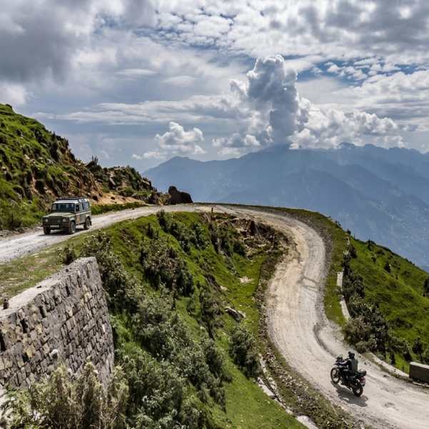
Light 4x4 vehicles remain the safest category for this road. If you have a Mahindra Thar, Force Gurkha, Toyota Fortuner, or any capable 4x4, you are in the best position.
The "4x4 only" wording you will still see quoted around this route came from the late-May reopening notice, when the highway first came through and conditions were at their worst. We have not seen a formal notification lifting it, and the district status feed still carries it. But that feed also still asks for snow chains at Kunzum well into the open season, which is not a real condition, so read it as an advisory nobody refreshed rather than a live restriction. In every recent season it has eased within a fortnight of the road coming through. Ring a Manali or Kaza driver on the day if you need a definite answer.
What none of that changes is the Batal diversion, where ground clearance still decides whether you get there comfortably or not at all.
High-clearance SUVs like the Bolero, Scorpio, and similar vehicles are strongly preferred for the Batal to Chandratal stretch. Ground clearance matters more than engine power on this road.
Experienced bikers can attempt the route, but only when the road is dry, open, and locally confirmed. Water crossings on a loaded motorcycle are a different challenge than in a car. Do not attempt this on a day when heavy rain is forecast on the Manali side.
Sedans are not recommended for the Batal to Chandratal road. The ground clearance is too low, the gravel can scrape the underside, and there is no recovery support if you get stuck. This is true whatever any advisory says.
Self-drive travellers in rented cars should be extra careful. Recovery support is limited on this route. Mobile network is unreliable or absent near Chandratal. If your car breaks down on the diversion, you could wait hours before anyone passes by.
Are Chandratal Camps Open in 2026?
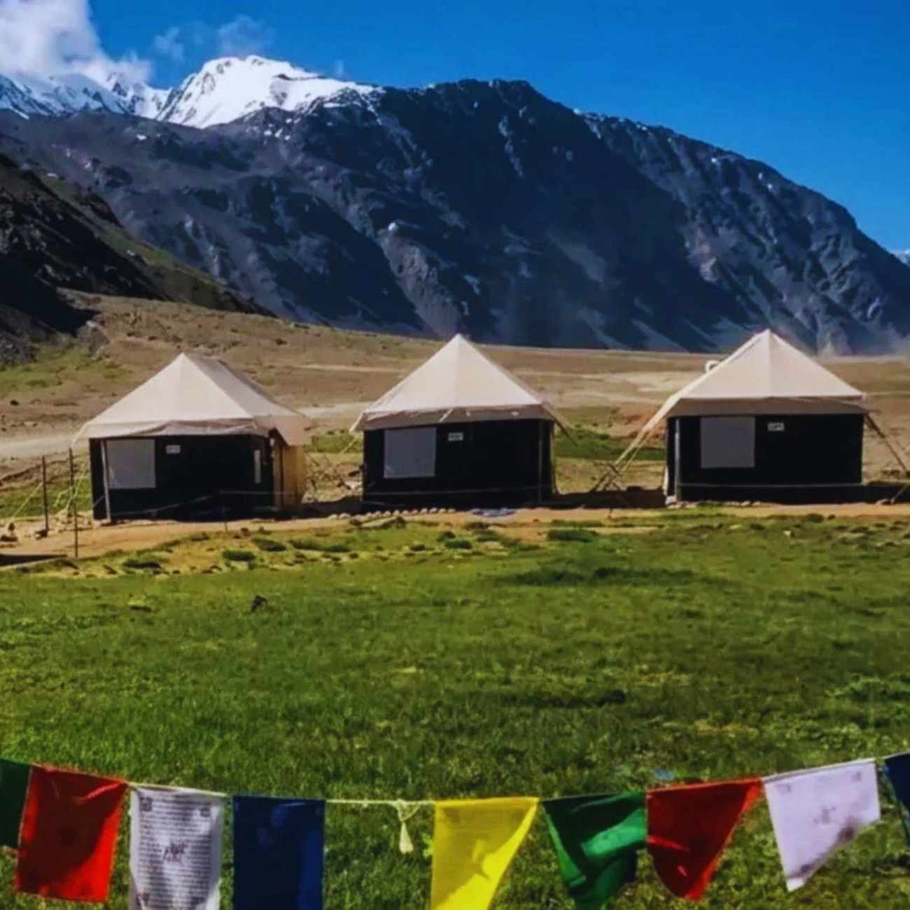
Yes. As of September 7, 2026, camps near Chandratal are fully operational. They came online through mid-June, and early September is still firmly in the season. This remains one of the more reliable stretches of the year for a confirmed overnight stay.
Even so, book ahead rather than turning up. Camps have limited tents, the season is busy, and if a road block holds people at the lake for an extra night, capacity tightens quickly.
Organised camps near Chandratal generally cost around ₹1,200 to ₹2,500 per person per night. Prices change depending on the camp, the season, and what is included. Always confirm the exact cost, meal inclusions, and bedding before booking.
One thing that catches people off guard: camps are not located directly at the lakeshore. Camping on the Chandratal lakeshore is not allowed. The lake is a protected Ramsar wetland, and the Koksar Panchayat enforces a ban on lakeside camping to protect the ecosystem. Camps operate in designated zones 2 to 5 km from the water, and you walk toward the lake from the camp. This is the right way to protect the lake and it does not take away from the experience.
For the full month-by-month camping breakdown, our Chandratal 2026 opening guide covers when camps typically start and when they shut down for the season.
Chandratal Permits, Entry Fee and Rules in 2026
An e-Aagman vehicle e-permit is required for the Atal Tunnel to Rohtang to Koksar to Chandratal circuit. This is a free vehicle entry registration, not a personal permit. Register at eaagman.hp.gov.in before you leave Manali. If you are approaching from the Kaza and Sumdo side rather than through the Atal Tunnel, the same e-Aagman system still applies on district entry, so register either way.
The entry fee for Chandratal is ₹150 for Indian nationals and ₹500 for foreign nationals, collected at or around the Batal checkpost. Carry cash because UPI and card machines do not work reliably this far out.
Foreign nationals may additionally need a Protected Area Permit (PAP) from the SDM office in Kaza or Keylong. Indian nationals do not need an Inner Line Permit for Chandratal.
A SADA fee (Spiti Area Development Authority) is collected at barriers for vehicles entering Spiti: ₹100 for two-wheelers, ₹200 for cars, ₹300 for SUVs, and ₹400 for buses.
Chandratal was declared a Ramsar Site in 2005. This means it is an internationally recognised wetland and the rules around it exist for a reason. No camping on the lakeshore. No littering. Carry your trash out. Flying drones at Chandratal is prohibited. This is an ecologically sensitive Ramsar-designated zone, and violation can lead to fines and equipment confiscation.
For the full permit picture including ILP, Rohtang permits, SADA fees, and e-Aagman details, our Spiti Valley permit guide covers everything in one place.
Best Time to Visit Chandratal After It Opens
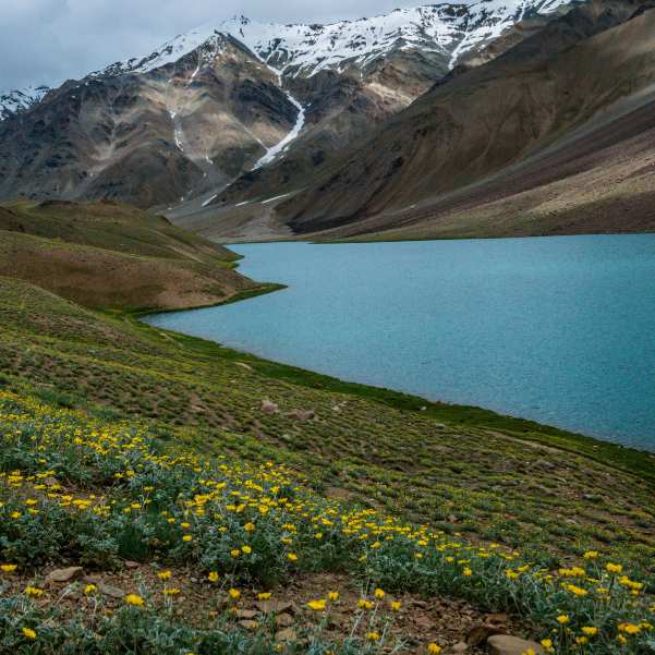
Early June is uncertain. The diversion may or may not be clear. Camps may or may not be running. Weather can swing from warm sunshine to sudden snow. Plan for early June only if you have flexible dates and a solid backup plan that does not depend on reaching Chandratal.
Mid to late June is better. The diversion is usually clear by then, and some camps are operational. You might still see snow on the surrounding peaks, and the lake colours are vivid from snowmelt feeding into it. But do not assume everything is smooth. Verify camp and road status before you commit.
July is the easiest month for families and first-time visitors. Camps are running, road conditions are more settled, and daytime temperatures are the most comfortable they will be all season. July does bring rain on the Manali side, but the Chandratal area stays relatively dry. The trade-off is the monsoon on the approach, so build in a buffer day and keep your Manali-side plans flexible. If this is your first high-altitude camping trip, July is still your month.
August is similar to July but with a slightly higher chance of monsoon disruptions on the approach roads. The lake area itself stays manageable, but the stretch between Manali and Gramphu can get tricky. Build buffer days into your plan if you are travelling in August.
September is the best overall month for experienced travellers. Clear skies, fewer crowds, golden-brown landscapes, and some of the cleanest lake colours of the year. Nights get cold, often below freezing, but the views and the silence make up for it. Our team personally considers September the most rewarding month to be at Chandratal.
Early October can be beautiful, but it is risky. Camps start winding down around October 10. Sudden snow can close Kunzum with little warning, potentially stranding you on the wrong side of the pass. Only attempt October if your dates are fully flexible and you are comfortable with plans changing overnight.
If you are wondering whether Chandratal technically sits in Lahaul or Spiti and why that matters for your route, our Chandratal Lahaul vs Spiti guide clears up the geography.
What to Do If Chandratal Is Closed Today
Do not panic. And definitely do not force a closed or half-cleared road just for one photo.
If the Spiti route is open but the Chandratal diversion is not, you still have a great trip ahead of you. Kaza, Key Monastery, Kibber, Chicham Bridge, Tabo, and Langza are all accessible once you are in the Spiti circuit. These are not consolation prizes. They are some of the best high-altitude experiences in India.
If Kunzum Pass is open but the Chandratal diversion is blocked, you can still visit Kunzum Pass itself for the views, but only if local drivers and authorities confirm it is safe on that day.
Another option that works well: shift Chandratal to the end of your trip instead of forcing it at the start. If you are doing a full Spiti circuit, keep Chandratal tentative for the last day or two. By then, you have acclimatised, you have real-time local intel, and the road may have cleared while you were exploring Kaza.
In monsoon, one more rule applies. If rain is forecast and you are already at the lake, come down. Do not add a night hoping it clears. The people stranded in 2023 were not stuck because they drove into a closed road. They were stuck because the road closed behind them.
Our Best Selling Summer Spiti Circuit with Chandratal is designed exactly this way. Chandratal sits at the end, not the start. That gives you the highest chance of actually getting there.
Talk to our Himachal team on WhatsApp if you want to figure out the best plan based on what is open right now.
How to Check Chandratal Live Road Status Before Leaving
Do not leave for Chandratal based on a single source. Use this verification order.
First, check the SEOC daily report. The Himachal State Emergency Operation Centre publishes a public utility report every morning and evening through the monsoon, listing blocked roads district by district and confirming whether the national highways are open. This is the most reliable official picture of what is shut across the state on any given day, and it is the source most news reports are quoting.
Second, check recent news. Search for "Kunzum Pass" or "Chandratal road status" in Google News. Look at the date of the article. In monsoon season, anything more than two or three days old may already be outdated.
Third, check the official Lahaul-Spiti road status page at hplahaulspiti.nic.in/road-status. Useful, but read it carefully. This page has a known lag and has shown Keylong to Kaza as closed well into the open season. Always check its last-updated stamp and cross-check it against ground sources before acting on it. A page carrying a stale date is not telling you about today.
Fourth, ask local taxi drivers. Drivers based in Kaza, Manali, Losar, or Batal know the ground reality before any website updates. A WhatsApp message to a local driver is often the fastest and most accurate check.
Fifth, ask camp operators. If the camp operator near Chandratal says tents are up and guests are staying, the road is open. If they say "not yet," believe them.
Sixth, ask Travel Coffee. Our team tracks road status daily during the season. We can give you a ground confirmation based on what our drivers and partners are reporting that morning. Reach us through our contact page or on WhatsApp.
Two numbers worth saving before you go: 1070 for the State Emergency Operation Centre and 1077 for the District Emergency Operation Centre. There is no mobile signal at Chandratal, so save them for the stretches where there is.
Do not trust only Instagram reels, old YouTube videos, or one random social media post. Road conditions in this region change overnight. Verify, verify, verify.
Recommended Itinerary Based on Today's Status
Explore Spiti Circuits with Chandratal
Current Spiti circuits with Chandratal, designed around real road conditions and proper acclimatisation.
 Group Tour9D/8N
Best Selling Summer Spiti Circuit With Chandratal
1D Sangla•1D Kalpa+3
₹18,999₹19,999SAVE INR 1,000/ person Group Tour10D/9N
Most Loved Shimla To Manali Spiti Circuit With Chandratal Lake
1D Shimla•1D Sangla+4
₹21,999₹25,999SAVE INR 4,000/ person 5D/4N
5D/4NManali to Chandratal Lake Road Trip
1D Sissu•1D Chandratal Camp
₹19,999₹23,999SAVE INR 4,000/ person Group Tour7D/6N
Spiti Short Circuit With Chandratal Group Tour From Manali
1D Manali•2D Kaza+1
₹14,999₹16,999SAVE INR 2,000/ person
If Chandratal Diversion Is Open
Go for the full circuit. Enter Spiti from the Shimla side via Kinnaur, spend time in Kaza and the surrounding villages, and then exit via Chandratal toward Manali. This gives you gradual acclimatisation across several days before you reach Chandratal at 14,100 feet.
This is the cleanest route for first-timers once the full road is open. You gain altitude slowly, see the best of Spiti, and end with Chandratal as the grand finale before dropping down to Manali. It also puts the monsoon-exposed Manali stretch at the end of your trip rather than the start, by which time you will have a much better read on the weather.
If Only Kunzum Is Open
Keep Chandratal tentative. You can explore Kaza, Losar, and drive up to the Kunzum Pass viewpoint if locally confirmed safe. But do not assume you can reach the lake. The diversion road is a separate stretch and may still be blocked.
Plan the rest of your Spiti itinerary as the main event. Kaza, Key, Kibber, Chicham, Langza, Hikkim, Tabo, and Dhankar are all worth multiple days. If the Chandratal diversion opens while you are in Kaza, you can add it. If it does not, you have not wasted your trip.
If Kunzum Closes Again
This happens. A landslide, a flash flood, or a late snowfall can close Kunzum even after it has been officially opened. If that happens, your plan is simple: Shimla to Kinnaur to Kaza, and return the same way.
This keeps your Spiti trip alive even if the Manali-Chandratal exit fails. The Shimla-Kinnaur route does not depend on Kunzum Pass and is usually more stable through the season, though NH-5 has its own monsoon pressure points and took cloudburst debris in Kinnaur in early July. Check it the same morning rather than assuming.
Browse our popular tours if you want to see which circuits are running right now based on current road conditions.
Related topics
FAQ
Is Chandratal Lake open today in September 2026?
Yes. As of September 7, 2026, Chandratal Lake is open and the camps are running. Kunzum Pass, the Gramphu-Kaza-Sumdo highway and the Batal to Chandratal diversion have all been through since June. On the SEOC report of September 5, Lahaul and Spiti had just one blocked link road and Kinnaur was not on the blocked list at all. The catch now is weather, not snow: the state is in a relative lull of light showers, but the IMD has a fresh, more widespread spell of rain likely from around September 11. Confirm the same morning you plan to travel.
Is Kunzum Pass open today?
Yes. Kunzum Pass has been open since BRO completed snow clearance from both sides in late May 2026, and no closure has been reported on the latest reports. In peak season the pass itself is rarely the problem. The Gramphu to Batal stretch below it is the part that blocks in heavy rain. Recheck the same morning you plan to cross.
Is Manali to Chandratal open today?
Yes, but this is the monsoon-exposed side of the trip. On the SEOC report of September 5, Lahaul and Spiti had just one blocked link road, none on this highway, but Kullu district has carried among the highest road-blockage counts in the state all monsoon, including in the Manali subdivision. Water crossings on the Gramphu to Batal stretch are lowest before 10 AM and get deeper through the afternoon. Start early and check the day's position before you commit.
Is Kaza to Chandratal open today?
Yes, and in monsoon this is the more dependable side. Spiti sits in a rain shadow and has been among the driest parts of the state this season. It can be raining hard in Kullu while Kaza stays dry. The 14 km Batal diversion still needs a same-day check before you attempt it.
Does Kunzum Pass opening mean Chandratal is open?
Not automatically. Kunzum Pass, the 14 km Batal diversion, and camp readiness are three separate stages. All three are complete for the 2026 season, so this matters less in early September than it did in June. It matters again from late September, when the sequence runs in reverse and the diversion and camps close before the pass does.
Will monsoon rain close the Chandratal road in September 2026?
It can, at short notice. The southwest monsoon entered Himachal on June 30, 2026 and stayed active through August and into September. Blocked roads across the state swung between roughly 100 and 185 through August, then eased through early September, sitting at 85 on the September 5 report. Chandratal itself sits in a rain shadow and usually stays comparatively dry, but it has exactly one road in and out, and that road runs through terrain that does get hit. The state is in a relative lull of light showers, but the IMD has a fresh, more widespread spell likely from around September 11.
Are Chandratal camps open in September 2026?
Yes. Camps near Chandratal came online through mid-June 2026 and are fully operational as of September 7. Early September is still firmly in the season and remains one of the more reliable stretches of the year for a confirmed overnight stay. Book ahead rather than turning up, since tents are limited and a road block can hold people at the lake for an extra night.
Can a sedan go to Chandratal?
Sedans are not recommended for the Batal to Chandratal road. The road is rough, unpaved, and has low ground clearance risks. A high-clearance SUV or 4x4 is strongly preferred year round, and especially after rain when water crossings deepen.
Do I need an e-Aagman permit for Chandratal?
Yes, a free e-Aagman vehicle e-permit is required if entering via the Atal Tunnel to Rohtang to Koksar to Chandratal circuit. Register at eaagman.hp.gov.in before you leave Manali. The same e-Aagman system still applies if you enter from the Kaza and Sumdo side, so register either way.
What is the entry fee for Chandratal Lake in 2026?
The entry fee is ₹150 for Indian nationals and ₹500 for foreign nationals, collected at or around the Batal checkpost. Carry cash as UPI and card machines do not work reliably in this area.
Is camping allowed at Chandratal Lake?
Camping on the Chandratal lakeshore is not allowed. The lake is a Ramsar wetland site and the Koksar Panchayat enforces a ban on lakeside camping. Camps operate in designated zones 2 to 5 km from the lake. Drone flying is also prohibited at Chandratal.
What should I do if Chandratal closes after I reach Spiti?
Continue your Spiti trip. Kaza, Key Monastery, Kibber, Tabo, Langza, Chicham, and Dhankar are all accessible when the Spiti circuit is open. Keep Chandratal tentative for the end of your trip and add it if the diversion clears while you are in the area. If you are already at the lake and heavy rain is forecast, come down rather than adding a night in the hope it clears.
More about Lahaul and Spiti
 Lahaul and Spiti
Shimla to Kaza in Winter 2026-27: Route, Road Conditions, Stops & Backup Plan
Plan your Shimla to Kaza winter journey for 2026-27 with this practical route and road guide covering the Kinnaur–Spiti route, expected road conditions, key stops, travel precautions, and essential tips for reaching Kaza safely during winter.
 Lahaul and Spiti
Spiti New Year Trip 2026 to 2027: Christmas, Snow Chances, Roads, Stays and December End Plan
Planning Christmas or New Year in Spiti for 2026-27? Real snow chances rather than promises, the winter Shimla-Kaza road reality, which Kaza stays stay open, what the celebration is actually like, how much the season adds to the cost, and a December 20 to January 2 plan with buffer days built in.
 Lahaul and Spiti
Spiti With Kids in Winter 2026: Is It Safe? Age, Altitude, Cold, Stays & Better Alternatives
Thinking of taking children to Spiti in winter? This honest guide covers what age can cope, how altitude affects kids differently, how cold Kaza really gets, what winter homestays actually provide, how far medical help sits, and when a lower Himachal destination is the smarter family decision.