

Kuppar Bugyal
A high altitude meadow at approximately 3,200 metres above Giri Ganga Temple in the Pabbar Valley, where the forest finally opens to grass and a full 360 degree view of the Pir Panjal, Swargarohini, Bandarpunch, and Kinnaur peaks, with nobody else around
What makes it special
Most bugyals in the Himalayas have a name people recognise. Kuppar does not, and that is the whole point.
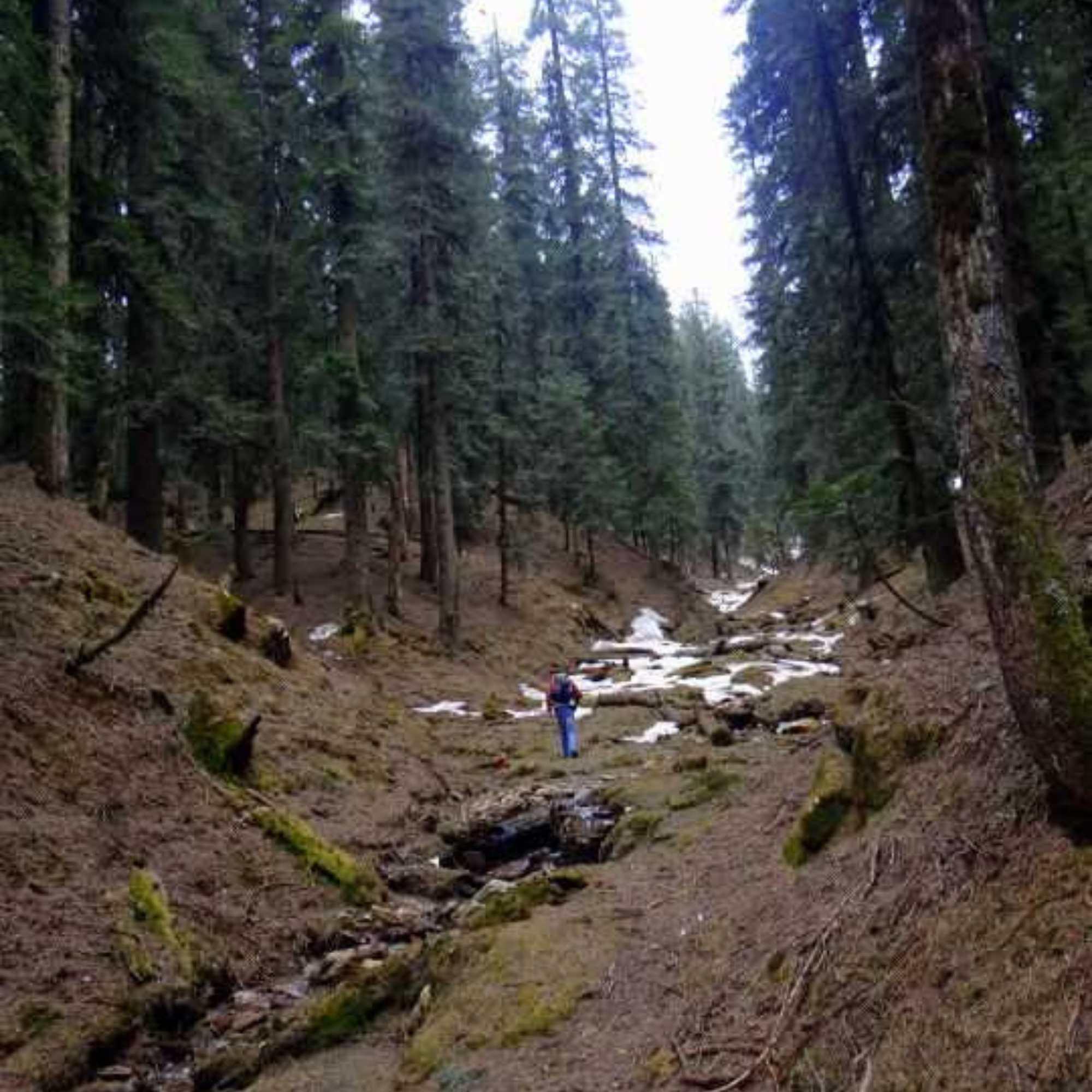
You start at Kharapathar, a small town at about 2,700 metres on the Shimla to Rohru road. From there, a rough dirt track runs 5 to 7 km through forest to Giri Ganga Temple. You can walk it in about 2 to 3 hours or bounce up in a high clearance vehicle. The track is unpaved, uneven, and turns to slush after rain. From the temple, the real hike begins: a steep, unsignposted 3 to 5 km climb through dense deodar and oak forest to the Kuppar Bugyal meadow at approximately 3,200 metres (~10,500 feet).
That forest section is the part most people underestimate. The canopy is thick enough to block out the sky in places, which traps cold, damp air even in summer. You will want a wind jacket regardless of the month. The trail forks repeatedly, and there are zero trail markers, no paint on rocks, no signboards, nothing. If the cloud rolls in, and it does, you can lose direction within minutes. This is why hiring a local guide from Kharapathar is not optional advice, it is a safety necessity. If you insist on going without one, download detailed offline maps before you lose signal, which happens shortly after Kharapathar itself.
There are no functional water sources along the steep climb past the temple. The spring everyone mentions is at the very top, near the summit, not on the trail. Carry at least 2 litres of water from below. People who assume they will find water along the way learn this the hard way.
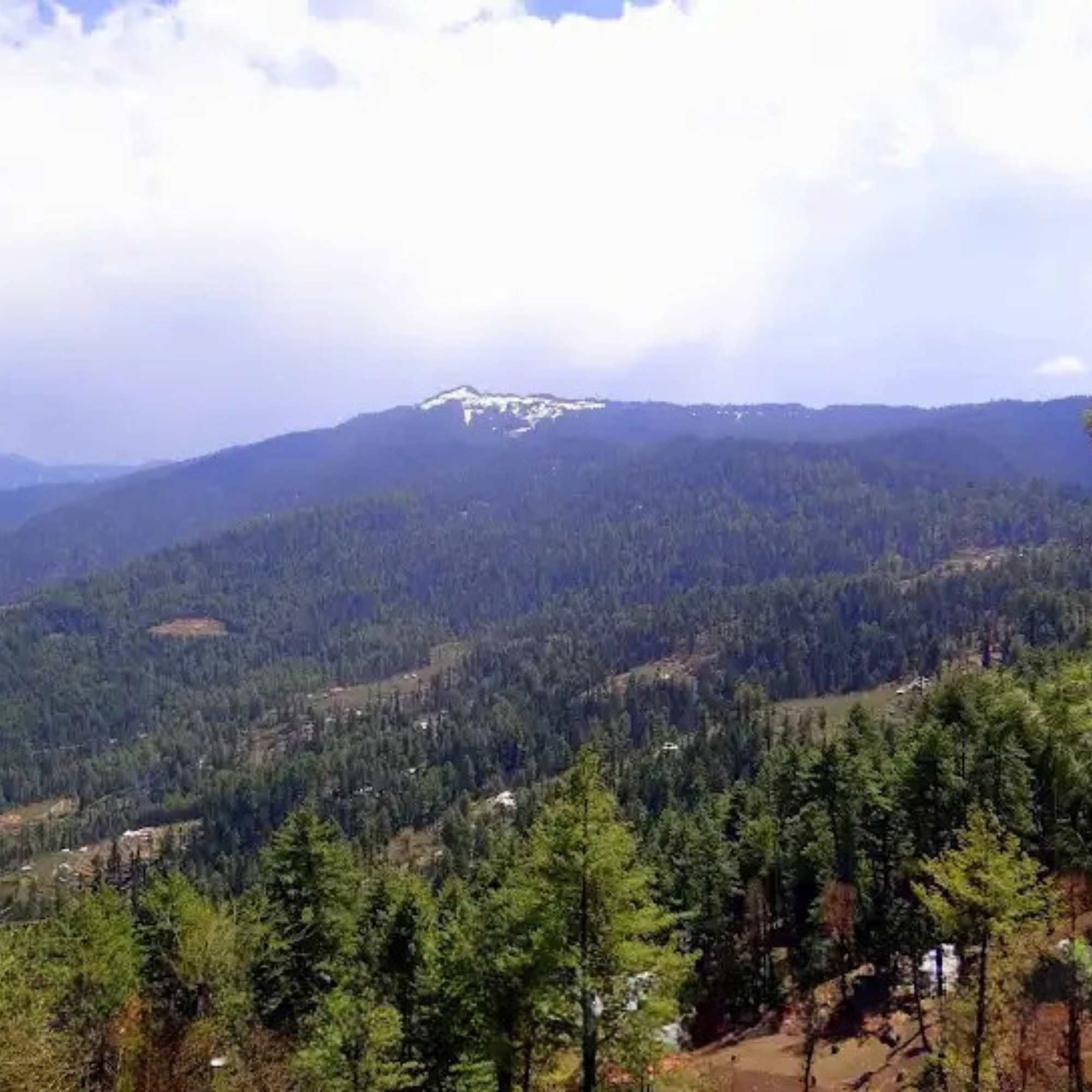
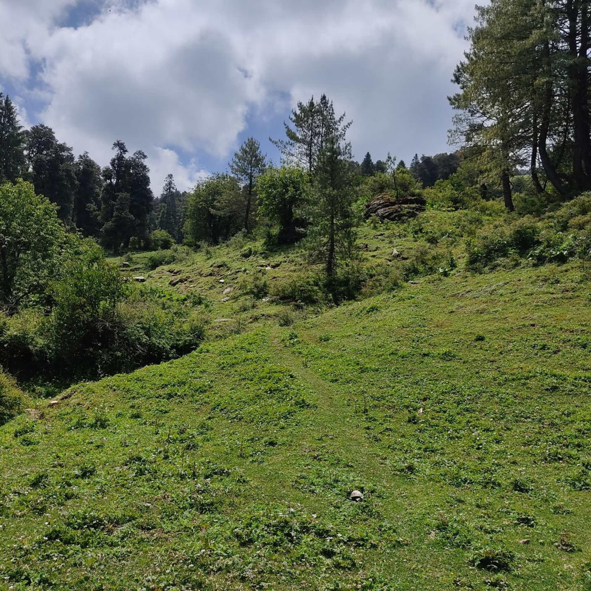
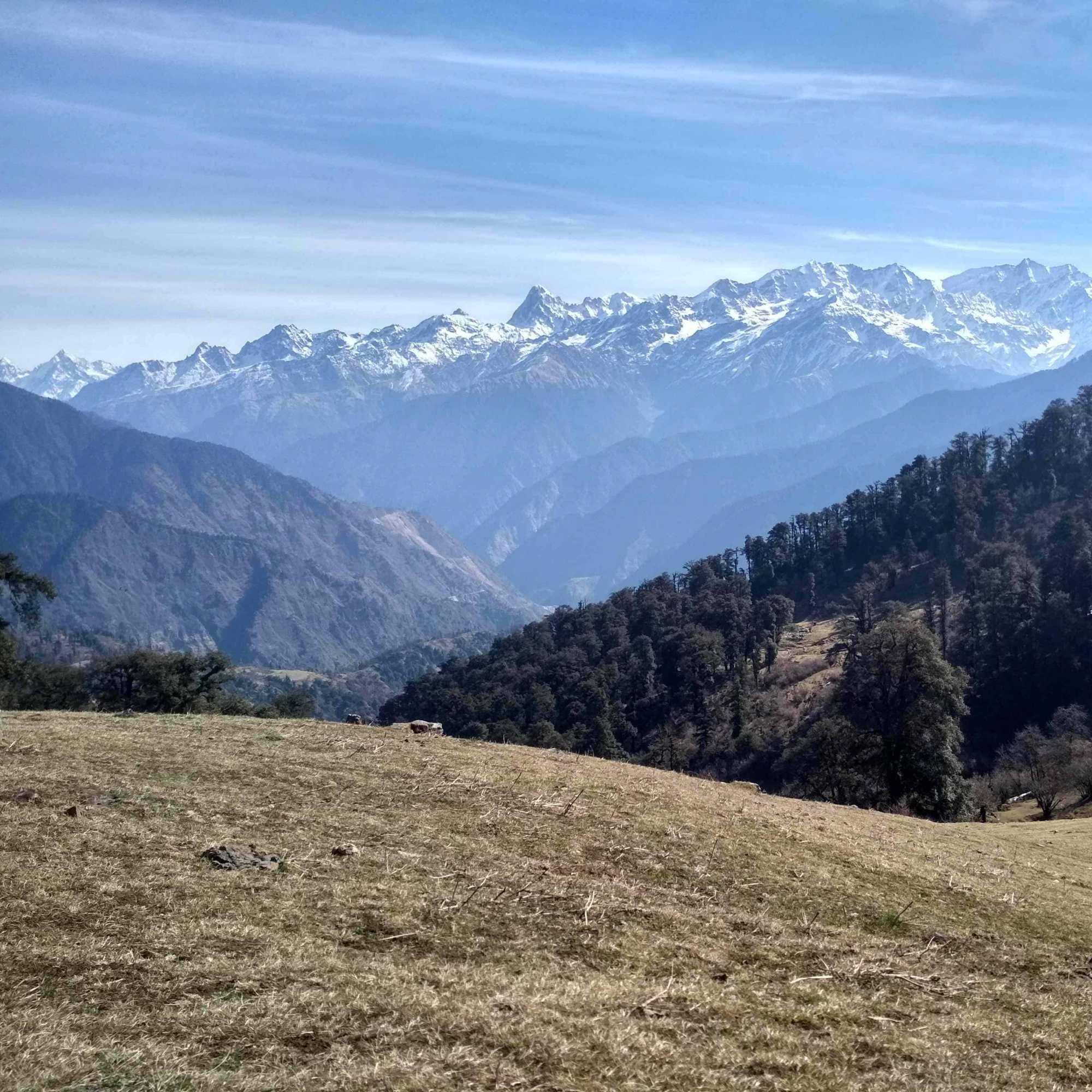
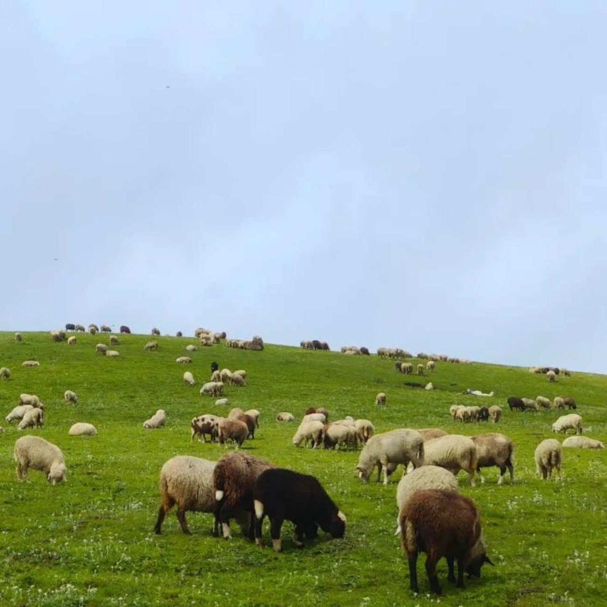
Then the trees thin, small clearings appear, and the forest lets go. The meadow runs about 600 metres in length, climbing gently another 50 metres toward the highest point. And the view, in every direction, is snow peaks. The Pir Panjal line runs across the north and east horizon. Swargarohini and Bandarpunch are clearly visible on a clear day. The Kinnaur peaks, including Hansbeshan at 5,420 metres, sit in the background. The Chanshal range appears to the northeast. Below you, the entire Pabbar Valley spreads out, with the forests and apple orchards of Kharapathar, Kotkhai, and Rohru laid out like a map.
A GPS reading at the top confirms roughly 3,200 metres. Some local sources claim higher numbers. Multiple trekkers with instruments have confirmed 3,200.
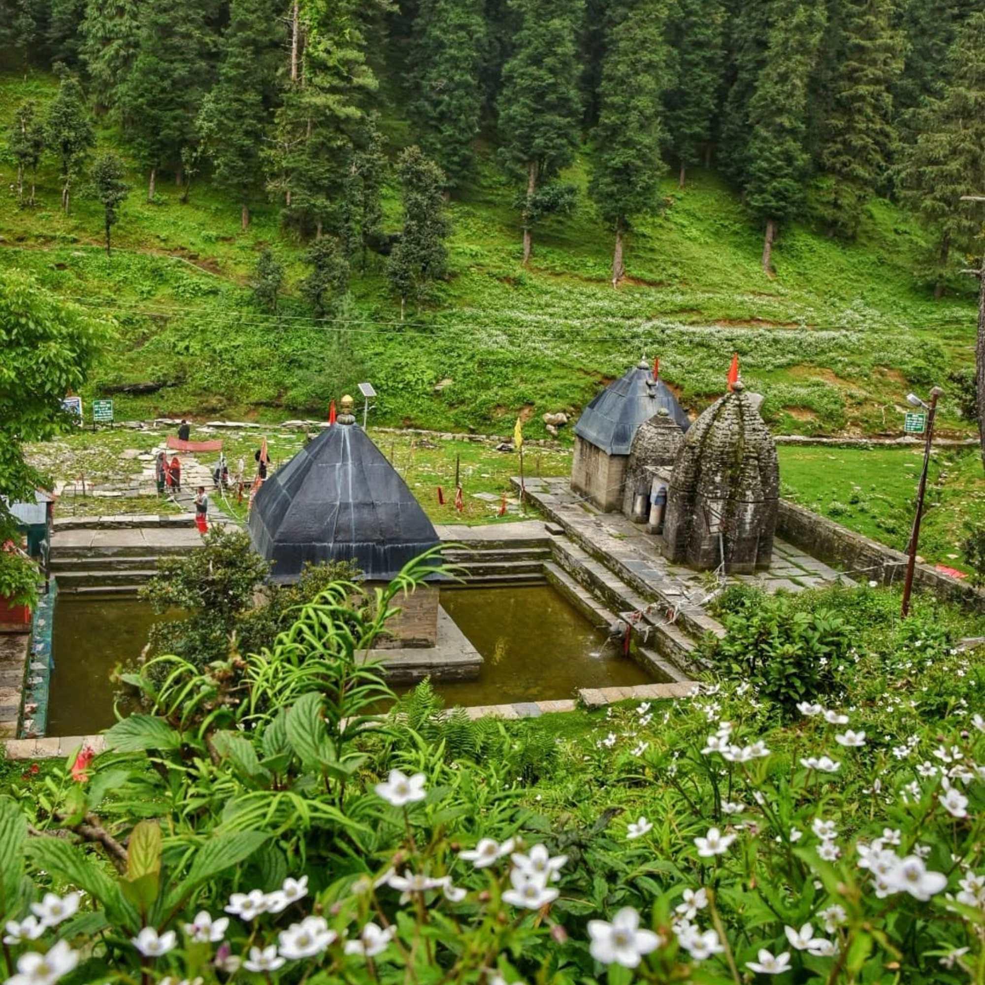
Just below the summit, a natural spring emerges from the ground. This is believed to be the origin of the Giri Ganga stream. The water that starts here flows down through the forest, past the ancient temple, and into the Giri Ganga river, a tributary of the Yamuna. Near the top, weathered rock cut images of a goddess are carved into the stone. These are old, easy to miss, and connected to the same tradition that built the temple below. A simple stone shepherd's shelter is the only structure on the bugyal. No dhaba, no tent camp, no signboard. Just grass, wind, and peaks.
Camping on the meadow requires permission from the Himachal Pradesh Forest Department. Check with the forest rest house in Kharapathar before heading up. Carry your own tent, a sleeping bag rated for sub zero temperatures, a stove, food, and water purification. There is nothing at the top except the spring water, and you must purify that too. The wind at 3,200 metres, especially after sunset, cuts through anything lighter than a proper jacket.
Honest framing. Kuppar Bugyal is not a trek for those who want a trail with milestones, tea stalls, and other trekkers for company. It is a short but remote hike in a forest with real wildlife, no mobile signal, and no trail markers, leading to a meadow where you are almost certainly alone. For the right person, that is exactly the appeal. If you want a proper Himalayan meadow experience without committing to a five day trek, and you are comfortable with basic conditions and genuine solitude, Kuppar is one of the best options within weekend reach of Shimla.
What is Kuppar Bugyal?
A high altitude alpine meadow at approximately 3,200 metres (~10,500 feet) in the Pabbar Valley, Shimla district. It sits above Giri Ganga Temple. The journey begins at Kharapathar: 5 to 7 km by rough road to the temple, then a steep, unsignposted 3 to 5 km forest hike to the meadow. 360 degree views of the Pir Panjal, Swargarohini, Bandarpunch, Chanshal, and Kinnaur Himalayan ranges. A natural spring near the summit is believed to be the source of the Giri Ganga river. No facilities at the meadow. No entry fee.
How hard is the trek?
Easy to moderate in terms of fitness. From Giri Ganga Temple, the trail is a steep 3 to 5 km climb through dense forest. Most people take 1.5 to 2.5 hours up and about 1 hour down. The difficulty is not the gradient but the lack of trail markings. The path forks repeatedly and the forest is thick enough to lose direction quickly, especially in cloud. A local guide from Kharapathar is strongly recommended. No technical skills needed, just proper shoes, water, and a wind jacket.
How much time do I need?
A long day trip from Kharapathar is possible if you drive to Giri Ganga Temple and start early. Better as an overnight: camp at the temple Dharamshala or at the bugyal itself. Two days from Kharapathar (one night) is the comfortable plan. Add 3.5 to 4.5 hours each way from Shimla to Kharapathar.
Quick facts
Everything you need to know at a glance
At a glance
On the ground
Seasonal weather
Suitable for
How to reach Kuppar Bugyal
3 approach routes with seasonal access
From Giri Ganga Temple (on foot)
Generally April to November. December to March the trail may be snow covered. Winter trek possible with proper gear and experience.From Giri Ganga Temple, the trail starts behind the temple complex and climbs steeply through thick forest. The canopy is dense enough to block out the sky in stretches, trapping cold, damp air even on warm days. Bring a wind jacket regardless of season. The trail shifts from deodar to oak and rhododendron as you gain altitude. Small clearings appear before the final stretch opens onto the meadow.
The path forks multiple times and there are zero trail markers anywhere. Getting lost here is a genuine risk, especially when cloud cover drops visibility. A local guide from Kharapathar is a safety necessity, not a luxury. There are no functional water sources between the temple and the summit spring. Carry at least 2 litres of water from below.
From Kharapathar (full trek)
Generally April to November for the full route. The dirt road section can be driven to save time.From Kharapathar, the first 5 to 7 km follows a rough dirt road through forest to Giri Ganga Temple. This section can be walked (2 to 3 hours) or driven in a local 4x4 or taxi (about 1 hour, roughly Rs 500 to 800 one way). From the temple, the remaining 3 to 5 km is on foot only, climbing steeply through dense, unmarked forest to the meadow. Most trekkers drive to the temple and walk from there. If you plan to walk the full distance, start from Kharapathar by 6 AM to have enough daylight for the round trip.
From Shimla
Year round to Kharapathar. Trek beyond depends on weather and snow.From Shimla, drive via Theog, Kotkhai, and the Shimla to Rohru road to Kharapathar (about 3.5 to 4.5 hours). HRTC buses to Rohru stop at Kharapathar. From Kharapathar, take a local taxi to Giri Ganga Temple (5 to 7 km, about 1 hour) and hike the final 3 to 5 km to the meadow. A weekend plan: drive to Kharapathar on day one evening, trek to Kuppar on day two, return to Shimla on day three. Carry enough cash from Shimla. No ATM in Kharapathar.
Best time to visit
Season-by-season breakdown to help you plan
Dry trails, wildflowers on the meadow, and the first clear views after winter.
Snow clears by April most years, and the meadow comes alive with wildflowers through May and June. The trail is dry and at its most manageable. Daytime temperatures on the bugyal sit around 10 to 15 degrees, but nights at 3,200 metres drop to near freezing even in May. The dense forest canopy keeps the trail cool and damp regardless, so carry a wind jacket for the climb. This is the best window for first time visitors and anyone planning to camp. Rhododendrons bloom in the upper sections, and morning views are clear before clouds build in the afternoon.
The forest is vivid green, but the trail is slippery, foggy, and leech heavy.
The meadow and forest are at their greenest, but the trail turns muddy and genuinely dangerous in sections. Leeches are common in the lower forest. Visibility at the meadow is often poor, with clouds sitting on the bugyal for hours. The dirt road from Kharapathar to Giri Ganga Temple becomes slushy and may be impassable for vehicles. Not recommended unless you are experienced with monsoon trekking and prepared for zero views at the top. The unmarked trail becomes even harder to follow when wet.
The clearest skies of the year. This is when Kuppar shows you everything.
October is the single best month for this trek. Post monsoon air clarity means the Himalayan ranges are sharper than any other season. The Pir Panjal, Swargarohini, Bandarpunch, and Kinnaur peaks appear with a detail you do not get in spring. The trail is dry. Crowds are nonexistent (they barely exist at any time). Nights are cold, dropping to minus 5 degrees or below on the meadow, so a proper sleeping bag is essential for camping. November gets genuinely cold, and early snow is possible by late November.
Snow covered meadow, deep cold, and a committed winter trek through forest.
Snow blankets the bugyal and much of the forest trail. The dirt road from Kharapathar is usually impassable by vehicle. Walking through snow covered forest to the meadow is a serious winter trek that requires proper gear, navigation ability, and experience. The already unmarked trail becomes nearly impossible to follow under snow without a guide who knows it well. Temperatures on the meadow drop to minus 10 or colder at night. Confirm conditions locally before attempting.
Things to see & do
4 experiences at Kuppar Bugyal
Trek to the meadow and take in the 360 degree views
3 to 5 hours round trip from Giri Ganga TempleThe main event. From Giri Ganga Temple, climb 3 to 5 km through forest that shifts from deodar to rhododendron as you gain altitude. The canopy is dense and traps cold air, so layer up. Small clearings appear first, then the tree line breaks and the bugyal opens up. Walk the full length of the meadow, about 600 metres, and climb the last 50 metres to the highest point.
On a clear day, the view covers Pir Panjal, Swargarohini, Bandarpunch, Chanshal, and peaks in Kinnaur. The Pabbar Valley stretches out below. Views are best in the morning or late afternoon. Budget 30 to 60 minutes at the top, more if you want to find the rock cut images of the goddess near the summit. Carry 2 litres of water because there is nothing between the temple and the summit spring.
Camp overnight on the meadow
OvernightThe reason to carry a tent and sleeping bag instead of doing this as a day trip. Camping on the bugyal puts you at 3,200 metres with no artificial light in any direction. The sunset, with the sun dropping behind the Pir Panjal, is worth the climb on its own. After dark, the sky is dense with stars. Mornings are cold but sharp, with the eastern peaks catching first light while you are still in your sleeping bag.
Forest department permission required. Carry a sleeping bag rated for minus 5 degrees even in summer. No firewood collection allowed, bring a stove. Water from the summit spring only, purify before drinking.
Visit Giri Ganga Temple on the way up or down
30 minutes to 1 hourThe ancient temple complex at the base of the Kuppar trail is worth more than a passing glance. Three shrines sit in a clearing surrounded by forest: the main one to Goddess Durga on a stone platform inside a sacred water tank (kund), and two others to Lord Shiva and Goddess Kali. The water in the kund is believed to originate from the spring at Kuppar above, completing the hydrological loop between the meadow and the temple. Remove shoes before approaching. If staying overnight at the Dharamshala, the temple at dawn is at its quietest.
Look for the rock cut images near the summit
15 to 30 minutesNear the highest point of the meadow, weathered rock cut images of a goddess are carved into the stone. These are old, worn by centuries of wind, and easy to walk past if you are not looking. Ask your guide to point them out. The carvings are connected to the same tradition that built the temple below, and finding them at 3,200 metres with no other human trace around gives the whole place a different weight.
Know before you visit Kuppar Bugyal
Essential information for planning your visit
Nearby attractions
Other places worth visiting nearby
 3 to 5 km below (on the trek route)
The ancient temple at the base of the Kuppar trail, at the source of the Giri Ganga river. Shrines to Durga, Shiva, and Kali. A Dharamshala for basic overnight stays. Most trekkers to Kuppar pass through the temple and many camp at the Dharamshala the night before the climb.
 Roughly 10 to 12 km (base town for the trek)
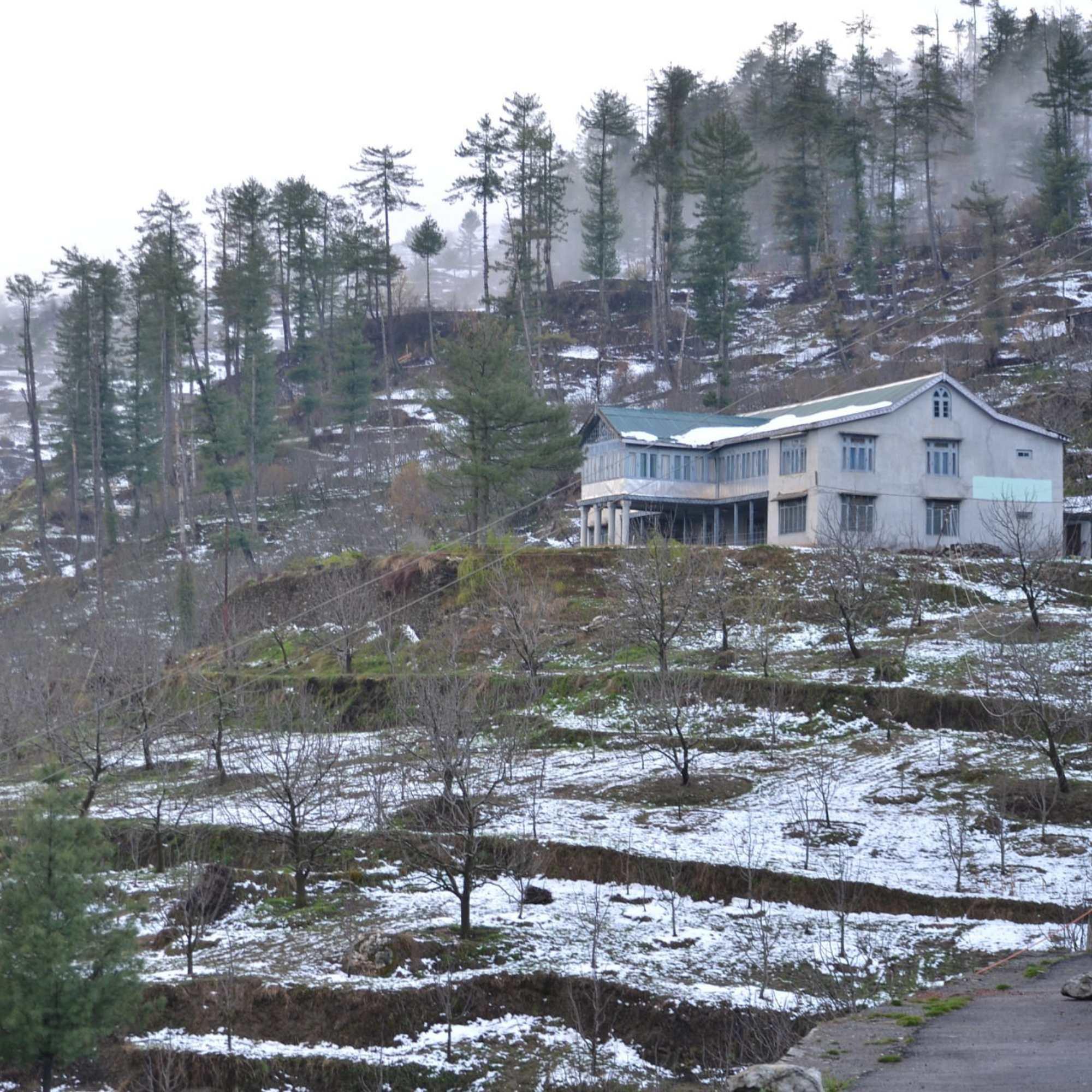
The small town at about 2,700 metres on the Shimla to Rohru road. HPTDC Giriganga Resort, forest department rest house, and guesthouses. The starting point for both the Giri Ganga and Kuppar treks. Apple orchards and the road to Chanshal Pass start here.
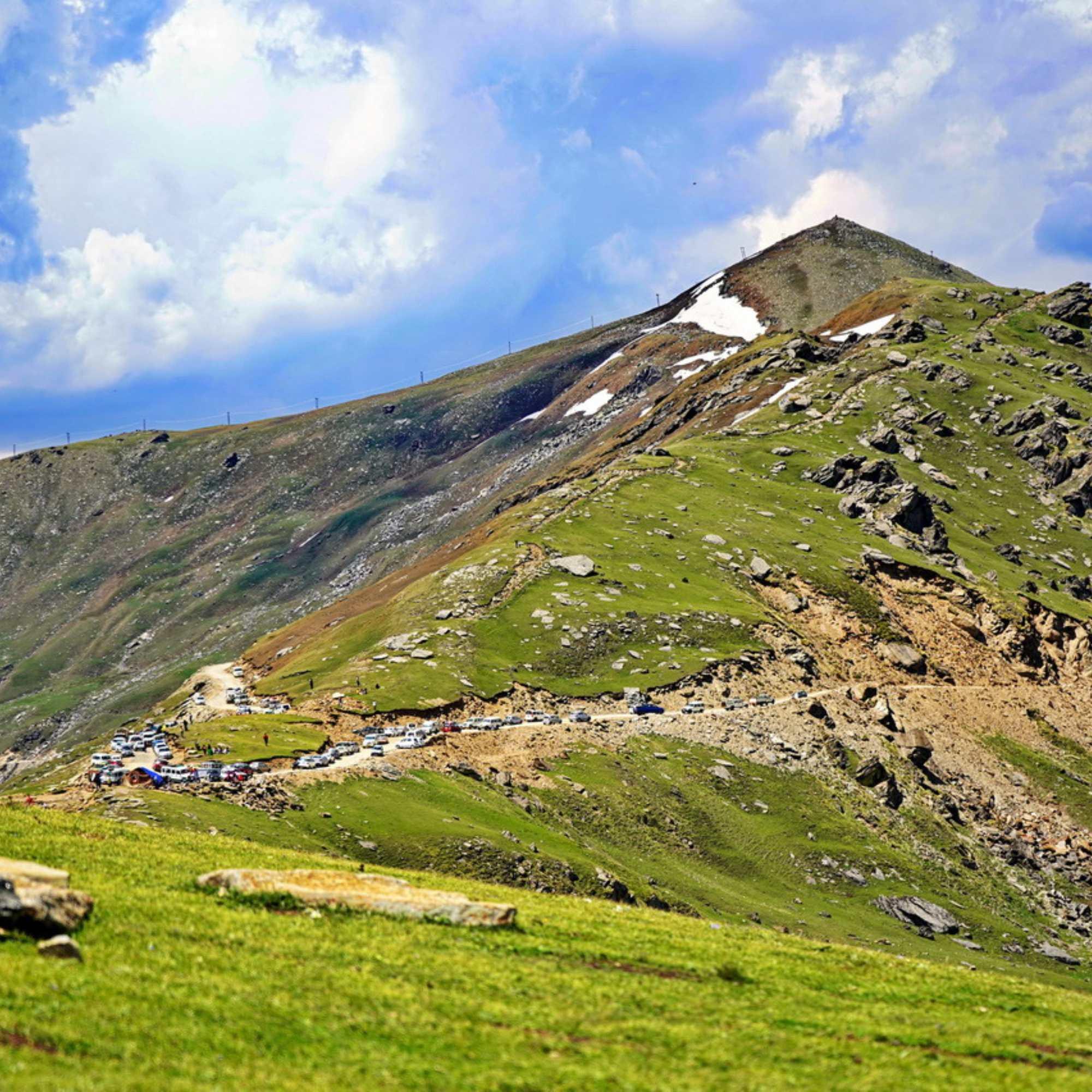 About 50 km from Kharapathar by road
One of the highest motorable passes in Himachal Pradesh at roughly 4,520 metres. The road from Kharapathar leads through the upper Pabbar Valley toward Dodra Kwar. Generally open June to October. A full day excursion that pairs well with a Kuppar trek on a longer trip.
 About 30 km from Kharapathar
The nearest town with a hospital, ATMs, and reliable services. Known for apple orchards and the annual Rohru fair. On the Shimla to Rohru road, and the practical stop for supplies before heading to Kharapathar.
Our Packages with Kuppar Bugyal
Curated trips that include a visit to Kuppar Bugyal
Planning a trip that includes Kuppar Bugyal?
Not sure where to start? Just tell us your dates and what you're looking for, and we'll help you plan a trip that actually fits you.