
Puga Valley Ladakh 2026: Hot Springs, Route from Hanle & Why It Fits Offbeat Ladakh
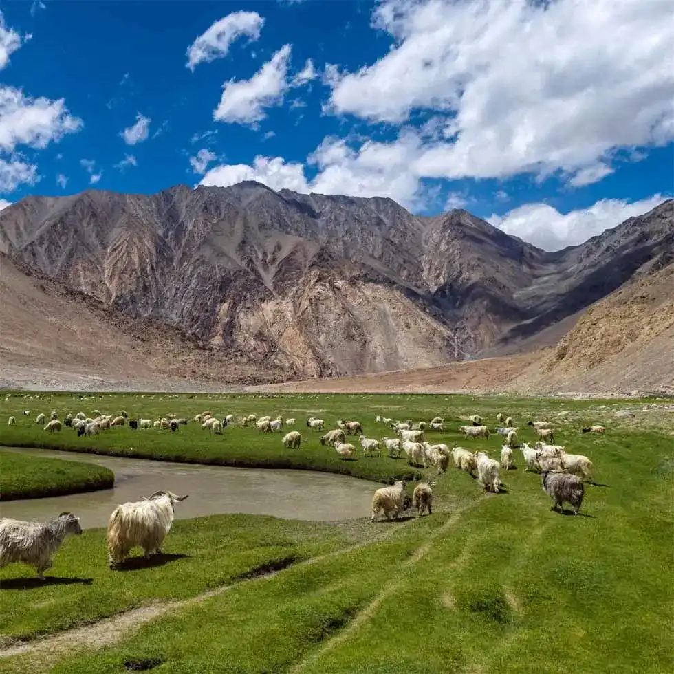
If you are reading about Puga Valley Ladakh, you probably found it while mapping a Hanle, Tso Moriri and Tso Kar trip and wondered if a "hot spring valley" is worth a detour. Short version: it is, but not the way most people imagine.
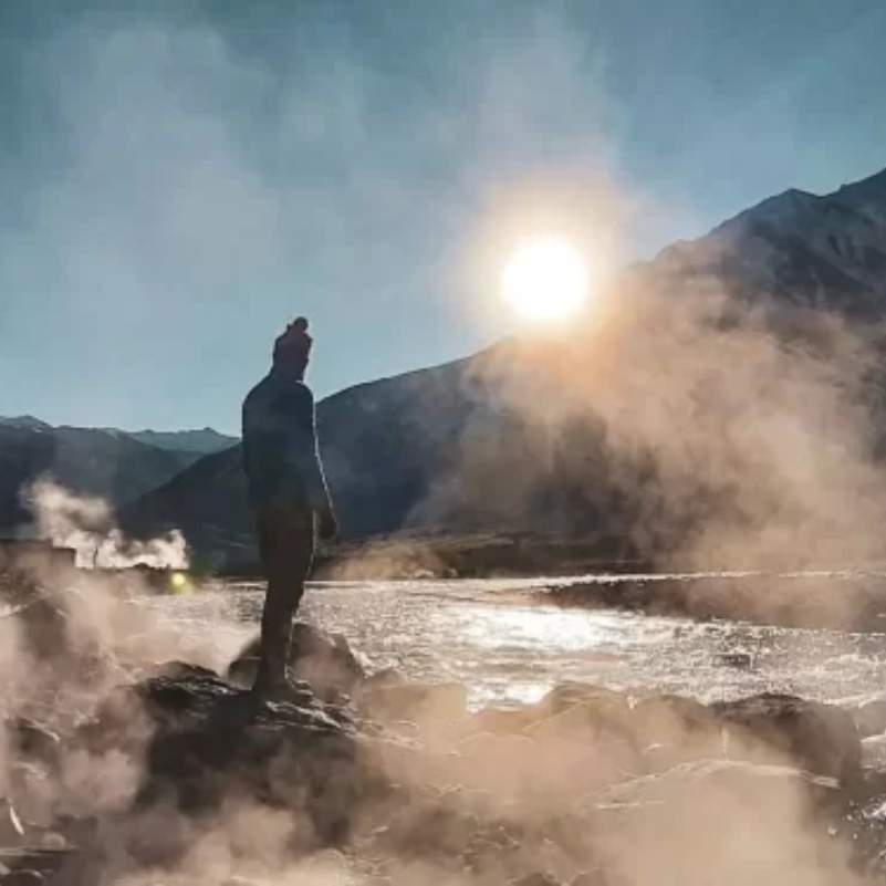
This is not a resort with warm pools you soak in. Puga is a raw geothermal patch in the middle of Changthang, with steam rising out of the ground, yellow and white mineral crusts, and bubbling springs you should mostly look at, not jump into.
In our experience sending travellers across the Changthang circuit, Puga works best as a 30 to 60 minute stop between Hanle and Tso Moriri, not as a destination you build a whole day around.
Quick Answer: Is Puga Valley Ladakh worth visiting in 2026?
Yes, if you treat it as a remote geothermal stop and not a developed hot spring resort. Puga Valley Ladakh sits deep in Changthang, on the road that links Hanle, Tso Moriri and Tso Kar.
You will see real hot springs, steam vents, mud pools and mineral patches across an open, marshy valley. There are no shops, no cafes, no proper toilets and no built bathing area.
Add it to a wider Changthang loop, reach it already acclimatised, and give it an hour. Do not drive across the country to see Puga alone.
If you want the full Ladakh loop handled end to end, our Ladakh tour package covers the permits, stays and a driver who knows these roads.
What Most Travellers Get Wrong About Puga
Most people picture a steaming pool they can sit in, like a natural spa. That picture is wrong, and it leads to disappointment and, worse, to people stepping onto ground that gives way.
Puga is a working geothermal field. The springs are sulphur-rich and hot, the ground around them is soft and unstable in places, and the "trail" is really just open valley.
Come for the strangeness of the place, the colours in the soil, and the silence. Not for a swim.
Where is Puga Valley in Ladakh?
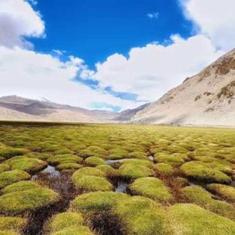
Puga Valley is in the Changthang region of southeastern Ladakh, on the same broad route as Tso Moriri and Tso Kar. The valley sits at roughly 4,300 to 4,400 metres, so altitude is a real factor here.
Most travellers reach it through the Mahe and Sumdo side after Chumathang. From Leh, the usual line is Leh, Karu, Upshi, Chumathang, Mahe, Sumdo, Puga Valley.
Now, the distance question. Leh to Puga is genuinely messy online. We have seen 140 km, 160 km, 170 km, 176 km, 180 to 200 km and even 250 km quoted across different sites.
Use 170 to 180 km as a planning range. More importantly, plan around drive time and buffer, not the kilometre number. On these roads the clock matters more than the map.
Why is Puga Valley Famous?
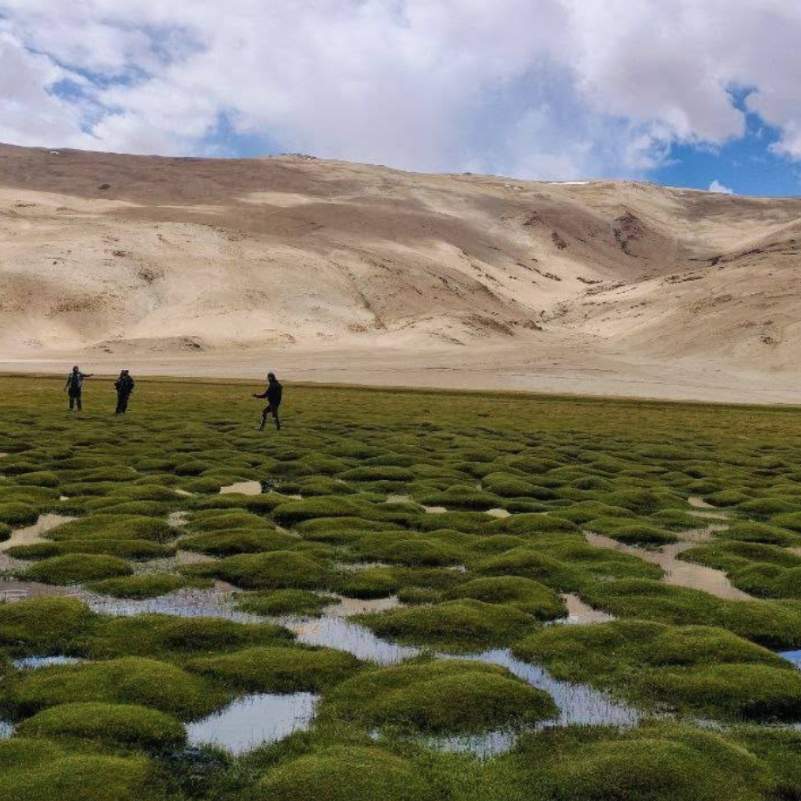
Puga hot springs Ladakh
The big draw is the Puga hot springs. The valley pushes out sulphur-rich hot water, steam vents, small mud pools and crusty mineral deposits across the ground.
Locals have long believed the mineral water helps with skin and joint discomfort. We mention that because you will hear it on the ground, but treat it as folk belief, not medicine. Do not go there expecting a cure for anything.
Geothermal valley Ladakh
Puga is one of India's important geothermal zones, and 2026 is an interesting year for it.
Ladakh approved a five-year extension of the ONGC geothermal MoU. The plan is for ONGC to set up a 1 MWe pilot geothermal power plant in Puga Valley, deepen the existing well to 1,000 metres, drill another geothermal well, with testing and commissioning expected in FY 2026 to 27.
There is a science angle too. In 2025, India's Department of Science and Technology reported that the travertine deposits formed by Puga's hot springs may help scientists study origin-of-life chemistry and even possible Mars biosignatures.
So this little valley is being studied both as future clean power and as a window into very old chemistry. Quietly impressive for a place with no signboard.
The landscape travellers actually come for
Strip away the science and what you actually get is a wide, quiet valley. Green marshy mounds sit next to white and yellow mineral patches, all of it ringed by the bare brown Changthang mountains.
There is almost no crowd. On most days you share it with a couple of vehicles and a lot of wind.
For photographers, the contrast is the appeal. Steam off the ground, hard mineral colours, and big empty mountains behind. It does not need filters.
How Do You Reach Puga Valley from Hanle?
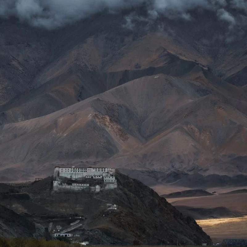
If you are coming from Hanle, the connection usually runs through the Loma, Nyoma, Mahe and Sumdo corridors, depending on what is open and permitted that season.
We will not hand you a fixed Hanle to Puga kilometre figure, because the honest answer is it shifts with road permissions and conditions. What we can anchor you on is the wider leg.
Hanle to Tso Moriri by the conventional Nyoma, Mahe and Sumdo road is about 150 km. Via Chumur it is about 180 km.
So the smart way to think about it is this: Puga is a stop along the way, not a separate trip. You hit Puga as you move from the Hanle side toward Korzok and Tso Moriri.
If you would rather not stitch this together yourself, our Ladakh road trip packages are built around exactly these Changthang legs.
Can You Do Hanle to Puga Valley to Tso Moriri in One Day?
Yes, but with conditions. This works only if you are well acclimatised, start early, have a local driver, get good weather, and keep a daylight buffer.
What we strongly warn against is trying Hanle to Puga to Tso Moriri to Leh all in one rushed day. That is too much altitude, too many checkpoints and too many hours unless your driver confirms the road is clean that morning.
Here is a real example of the confusion. A traveller on Reddit could not figure out whether covering Tso Moriri and Puga from Hanle to Leh would take 7 hours or 10 plus hours.
The honest answer is: it can swing that wide. High-altitude roads, photo stops, checkpoints and sudden weather delays make map timings unreliable. Plan for the long end, not the short end, and you will not be stuck driving a mountain road in the dark.
What we always tell our travellers is to fix the day around reaching the next bed before sunset, then work backwards. If Puga has to be a quick stop to make that happen, make it a quick stop.
Puga Valley to Tso Moriri: What is the Practical Route?
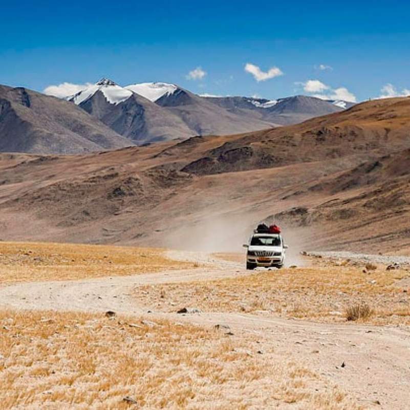
From Puga, most travellers move through the Sumdo side toward Korzok and Tso Moriri. You may pass Kyagar Tso as a route landmark along the way.
The exact Puga to Tso Moriri distance is another one that fights with itself online. Some sources say 22 km to Karzok, others 35 km to Tso Moriri, and others give wider route-based numbers.
What is solid: Tso Moriri sits at about 4,530 metres, runs about 26 km long and up to 5 km wide. It is a Ramsar Wetland, protected as the Tso Moriri Wetland Conservation Reserve.
Because of that protection, you cannot camp on the lake shore. Stay options are mainly in Korzok, the village beside the lake.
One honest negative here: Korzok stays are basic and fill up fast in peak season, so do not roll in at night assuming you will find a room. Sort it before you leave Leh or Hanle.
If this kind of high, quiet, offbeat travel is your thing, you will probably also like our offbeat Spiti Valley trips, which scratch the same itch closer to Himachal.
Puga Valley to Tso Kar and Leh: Should You Continue That Way?
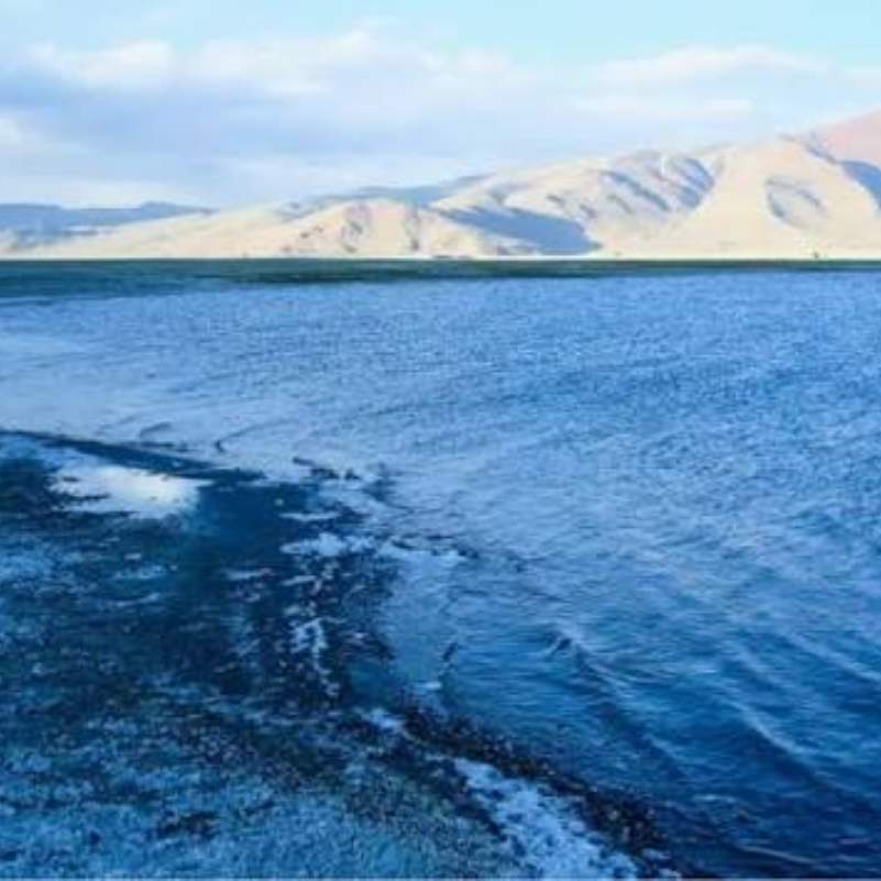
If you are heading toward Tso Kar and then Leh or the Manali side, the route logic flows nicely from Puga.
A common line is Karzok, Kyagar Tso, Sumdo, Puga hot springs, Pologongka La, Tso Kar. Puga sits naturally in the middle of this, which is part of why we slot it as a stop rather than a stop-everything destination.
Karzok to Tso Kar via this route is reported at around 78.6 km and 3 to 3.5 hours.
From there, Tso Kar to Leh is reported as about 153 km and 4 to 5 hours via the NH3 and Pang to Debring side.
If your trip ends on the Manali side instead of Leh, our Manali road trip packages can pick up the journey from where the Ladakh leg drops you.
Are Puga Hot Springs Safe for Bathing?
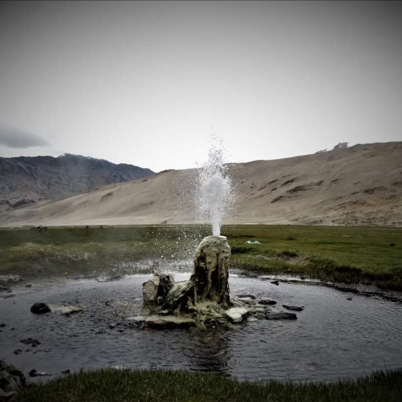
Let me be blunt. Puga is not a developed spa. It is not a built hot spring with steps and a clean pool. Not every pool is safe.
Temperatures vary from pool to pool, and so does the ground. Some spots have a fragile crust, marshy sulphur soil and unstable edges that look solid until they are not.
Do not step into unknown pools. Do not cut across the grassy wet mounds to save time. Do not use soaps or detergents anywhere here.
Here is why this matters, told plainly. A traveller once tried a shortcut through the grass mounds at Puga and ended up spending close to two hours fighting his way back out of swampy sulphur ground.
That is the real risk. Not drama, just soft ground in a remote place with no help nearby. Stay on firm footing, look from a safe edge, and keep your shoes on.
If you want a developed hot spring experience on the way, Chumathang earlier on the Leh route is the better-known hot spring stop with a few basic dhabas, and it is your last proper warm-meal area before the valley opens out.
Best Time to Visit Puga Valley Ladakh in 2026
The practical window is June to September. Late May to early October can also work, but only with fresh road and weather checks before you go.
September is our quiet favourite for clearer skies and cleaner photos. October needs caution because the cold sets in fast and early snow can cut routes without much warning.
Winter, November to April, is not for most travellers. The whole Changthang side becomes a serious cold-weather expedition, not a road trip.
One thing people forget: even in summer, Puga can be windy and genuinely cold because you are at 4,300 to 4,400 metres. A sunny afternoon can flip to a biting wind in minutes.
A small timing tip from our drivers: hit Puga in the first half of the day. The light is better for photos, the wind is usually softer than late afternoon, and you keep your daylight buffer for the drive to Korzok or Tso Kar.
Do You Need Permits for Puga Valley, Hanle and Tso Moriri?
Yes, this whole belt needs permits and fees, and the cleanest way to handle them is the official Leh District Tourist Management System on the LAHDC Leh portal.
The official portal lets you pay tourist fees online, and these include an environmental fee, a Red Cross Fund contribution and a wildlife fee.
On amounts: the environmental fee is ₹400 per person. The wildlife fee is ₹20 per person per day. The Red Cross contribution shows up as ₹50 in several 2026 guides, though some sources say ₹50 to ₹100.
Indian travellers should carry an original ID and several printed copies, because checkpoints will ask and one copy is never enough.
Foreign nationals and certain passport holders need a Protected Area Permit for the protected and restricted sectors. For Hanle, Chushul and Umling La style areas the rules can change, so confirm locally before you lock dates.
Here is a quiet money and time tip. Paying these fees yourself on the official portal avoids handing the job to a middleman who may add a margin. It takes a few minutes and keeps the cost transparent.
Road Condition, Fuel, Network and Facilities

Set your expectations low on facilities and you will be fine. There are no proper shops, no cafes, no restrooms and no formal viewing platform at Puga itself.
Public transport here is close to nonexistent. A private taxi, an SUV or a bike is the realistic way to reach the valley.
Fuel is a real concern. One source says there are no fuel stations after Karu or Upshi, so tank up early and carry a buffer. Running low in Changthang is not a mistake you want to make.
Network is weak to absent across this stretch, so download offline maps before you leave Leh and tell someone your plan.
On the road itself, expect a mix of paved sections, rough gravel, broken patches and water crossings, plus weather-dependent delays. This is exactly why we keep saying buffer time over distance.
Suggested Offbeat Ladakh Itinerary with Puga Valley
7 to 8 Day Balanced Route
Start with proper acclimatisation in Leh, then ease into the trip. Spend your first two days in and around Leh letting your body adjust, then depending on how long your trip runs, you can add Nubra or Pangong before turning toward Changthang.
From there, the heart of the trip runs Leh to Hanle, then Hanle to Puga Valley with a short stop at the hot springs, on to Korzok and Tso Moriri, then Tso Kar, and finally back to Leh or out toward the Manali side. This keeps Puga as a natural stop rather than a forced detour.
9 to 10 Day Slower Route
If you are travelling as a couple, with family, or it is your first time in Ladakh, stretch the same route over nine or ten days. The extra days are not wasted. They are buffer for weather, altitude and the simple fact that these roads run slow.
A slower plan also lets you avoid night driving completely, which is the single biggest safety upgrade you can make in Changthang. We build our trips this way for a reason.
Who Should Skip Puga
Skip Puga if you are short on time, not acclimatised, or trying to squeeze too much into too few days. Seniors with health concerns and families with toddlers should think hard before adding this high, remote leg.
And if you are picturing a resort-style hot spring you can soak in, skip it. You will be let down. Puga rewards the curious traveller, not the comfort-seeker.
What to Carry for Puga Valley

Pack for cold and wind even in summer. Bring layered clothes, a windproof jacket, waterproof or sturdy shoes, sunglasses, sunscreen and lip balm, because the UV up here is harsh and the wind is constant.
Carry water and high-energy snacks, a power bank, your ID with permit copies, basic medicine and offline maps. If you travel with an operator, oxygen and first-aid support should be in the vehicle.
On health, the official advisory is clear. Complete at least 48 hours of acclimatisation in Leh before heading to high altitude. Drink 2 to 3 litres of water a day and avoid alcohol, smoking and sedatives.
We will not tell you which altitude tablet to take. Talk to a doctor before your trip and follow their advice on medicines.
Responsible Travel in a Fragile Geothermal Valley
Puga is delicate, so travel light on it. No shortcuts across the marshy ground, no touching unknown pools, and no plastic left behind.
Keep soaps and detergents out of the springs entirely. Do not disturb wildlife or the Changpa pastoral areas you pass through.
Skip drone flying in sensitive zones unless it is clearly allowed, and please do not chase risky reels near the steam vents. The ground there is the whole reason to be careful.
For context, the geothermal project drew environmental concern after a geothermal fluid release into the Puga Stream back in 2022. That is not a closure today, but it is a reminder that this valley is being watched, and your footprint matters.
If high, fragile mountain landscapes pull at you, our summer Spiti circuit with Chandratal takes the same careful approach on the Himachal side.
Explore Our Curated Leh Ladakh Tours
 6D/5N
6D/5NUltimate Leh Ladakh Tour Package with Nubra Valley & Pangong Lake
2D Leh•1D Nubra Valley+1
₹28,999₹35,999SAVE INR 7,000/ person 6D/5N
6D/5NBest Selling Leh Ladakh Tour With Nubra Valley and Pangong Lake
2D Leh•1D Nubra Valley+1
₹23,999₹28,599SAVE INR 4,600/ person 4D/3N
4D/3NLeh Ladakh Short Getaway
2D Leh•1D Pangong Lake
₹16,499₹19,999SAVE INR 3,500/ person
Related topics
Frequently Asked Questions
Where is Puga Valley located in Ladakh?
Puga Valley is in the Changthang region of southeastern Ladakh, on the route linking Hanle, Tso Moriri and Tso Kar. It sits at roughly 4,300 to 4,400 metres.
What is Puga Valley famous for?
It is famous for its sulphur-rich hot springs, steam vents, mud pools and mineral deposits. It is also one of India's important geothermal zones, now lined up for an ONGC pilot power plant.
How do I reach Puga Valley from Hanle?
From Hanle you usually connect through the Loma, Nyoma, Mahe and Sumdo corridors, depending on current road permissions. Puga then sits on the way toward Korzok and Tso Moriri.
Can I visit Puga Valley while going from Hanle to Tso Moriri?
Yes, that is the most common way to see it. Hanle to Tso Moriri runs about 150 km by the conventional route, and Puga slots in as a short stop along the way.
How far is Puga Valley from Leh?
Sources conflict badly, from 140 km up to 250 km. Use 170 to 180 km as a planning range and focus on drive time, not the exact number.
How far is Puga Valley from Tso Moriri?
This also varies online, with figures like 22 km to Karzok and 35 km to Tso Moriri. Treat all of these as approximate and confirm before you plan tight timings.
Are Puga hot springs safe for bathing?
No, not in the way a built spa is safe. The pools vary in temperature and the ground is unstable in spots. Look, do not soak, and never cut across the marshy mounds.
Do I need a permit for Puga Valley Ladakh?
You need the standard Ladakh tourist fees, payable on the official LAHDC Leh portal, which include an environmental fee of ₹400 per person plus wildlife and Red Cross fees. Foreign nationals need a Protected Area Permit for restricted sectors.
What is the best time to visit Puga Valley?
June to September is the practical window, with September best for clear skies. Late May to early October can work with road checks, but winter is not recommended for most travellers.
Is Puga Valley open in winter?
Practically no, for normal travellers. The cold and snow across Changthang from November to April turn this into a serious expedition rather than a road trip.
Are there hotels or homestays in Puga Valley?
No. There are no stays, shops or facilities at Puga itself. Most travellers stay in Korzok near Tso Moriri and treat Puga as a passing stop.
Is Puga Valley worth visiting or should I skip it?
It is worth it as a short, strange, beautiful geothermal stop on a wider Changthang loop. Skip it only if you are short on time, not acclimatised, or expecting a resort-style hot spring.
More about Ladakh
 Ladakh
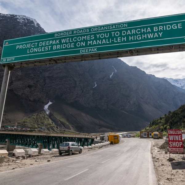
Manali to Leh Highway 2026: Every Pass, Stop and Distance
Plan your Manali to Leh Highway journey in 2026 with a complete guide to major mountain passes, overnight stops, route highlights, and distance. Discover key stops like Jispa, Sarchu, and Pang, along with famous passes including Baralacha La and Tanglang La.
- Road Trips
- How to Reach
 Ladakh
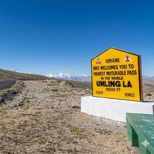
Umling La Ladakh Guide 2026: Route, Altitude, Permit, Safety & Reality Check
Planning to visit Umling La in 2026? This complete guide covers the route, altitude, permit requirements, road conditions, safety tips, and the realities of travelling to one of the world's highest motorable roads.
- Road Status
- Altitude & Health
 Ladakh
Turtuk Ladakh Travel Guide 2026: Balti Culture, Apricot Orchards and Why It Is Perfect for Families
Planning a trip to Turtuk? This 2026 travel guide explores the village's rich Balti culture, beautiful apricot orchards, top attractions, travel route, and why Turtuk is one of the best family-friendly destinations in Ladakh.
- Places to Visit
- Family Travel